Plume and Ashfall at Klyuchevskaya
Downloads
- klyuchevskaya_oli_2015050.jpg (720x480, JPEG)
- klyuchevskaya_oli_2015050_lrg.jpg (5187x3458, JPEG)
- klyuchevskaya_oli_2015050_geo.tif (5187x3458, GeoTIFF)
Metadata
- Sensor(s):
- Landsat 8 - OLI
- Data Date: February 19, 2015
- Visualization Date: February 19, 2015
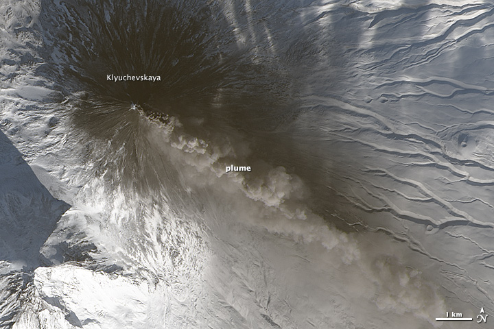
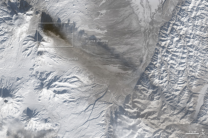
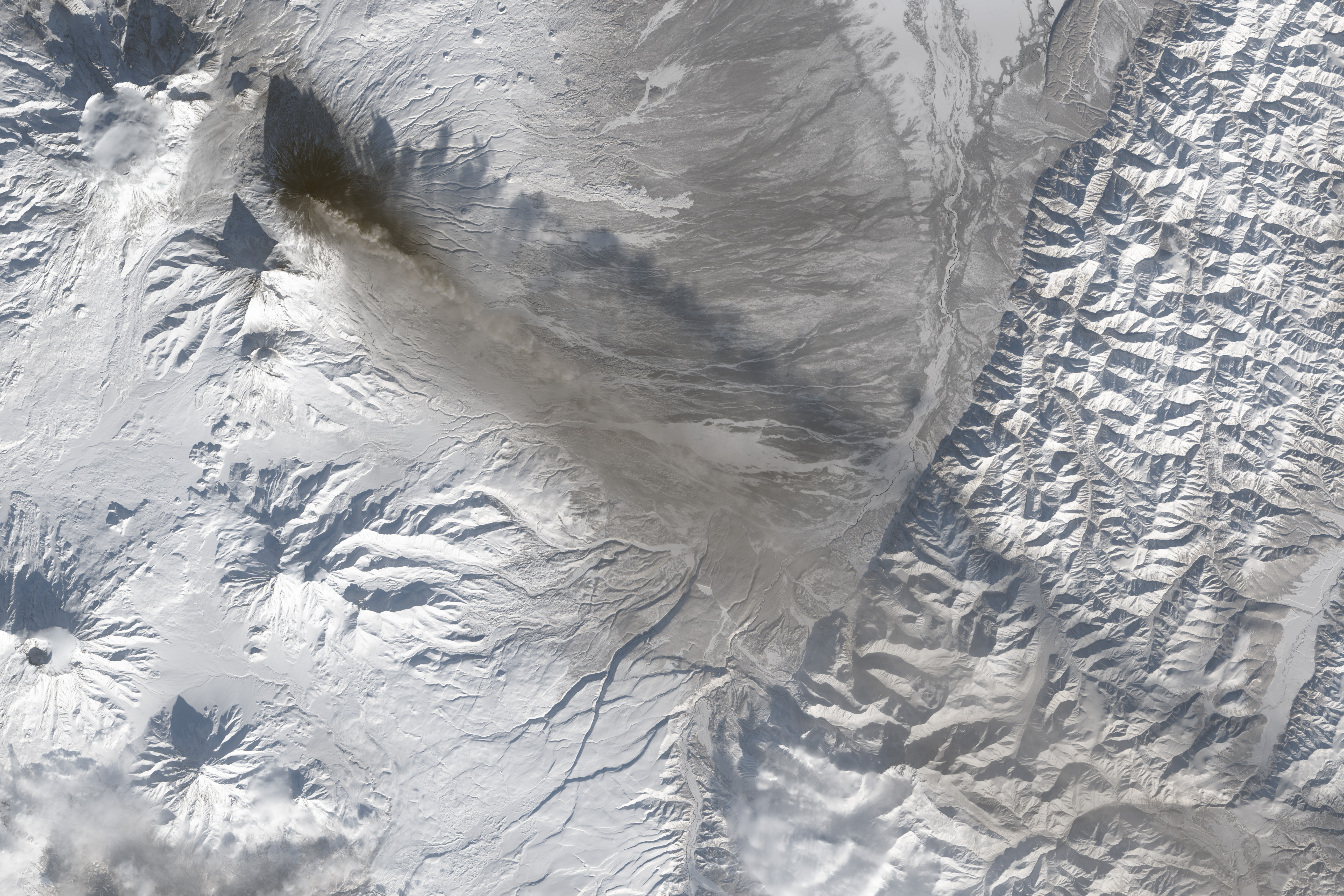
The Operational Land Imager (OLI) on Landsat 8 captured a natural-color view of Klyuchevskaya Volcano as it erupted on February 19, 2015. The top image is a closeup pulled from the second, wider view.
According to the Kamchatkan Volcanic Eruption Response Team (KVERT), a Strombolian and Vulcanian eruption has been ongoing at the volcano, with fresh lava, rock bombs, and ash plumes. The ash has reached as high as 8 kilometers (26,000 feet) on several days in mid-February, leading to a aviation code red in the area.
NASA Earth Observatory image by Jesse Allen, using Landsat data from the U.S. Geological Survey. Caption by Mike Carlowicz.
This image record originally appeared on the Earth Observatory. Click here to view the full, original record.