acquired January 18, 2015
Ashfall from Karymsky Volcano
Downloads
- karymsky_oli_2015018_lrg.jpg (3000x3000, JPEG)
- karymsky_oli_2015018_geo.tif (GeoTIFF)
Metadata
- Sensor(s):
- Landsat 8 - OLI
- Data Date: January 18, 2015
- Visualization Date: January 21, 2015
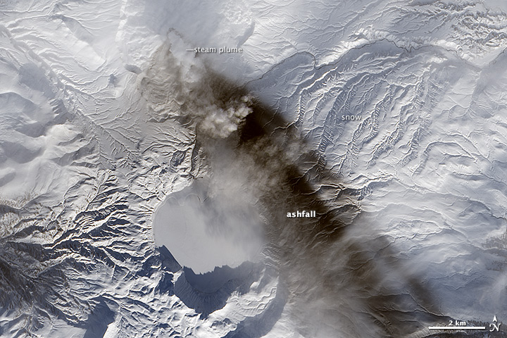
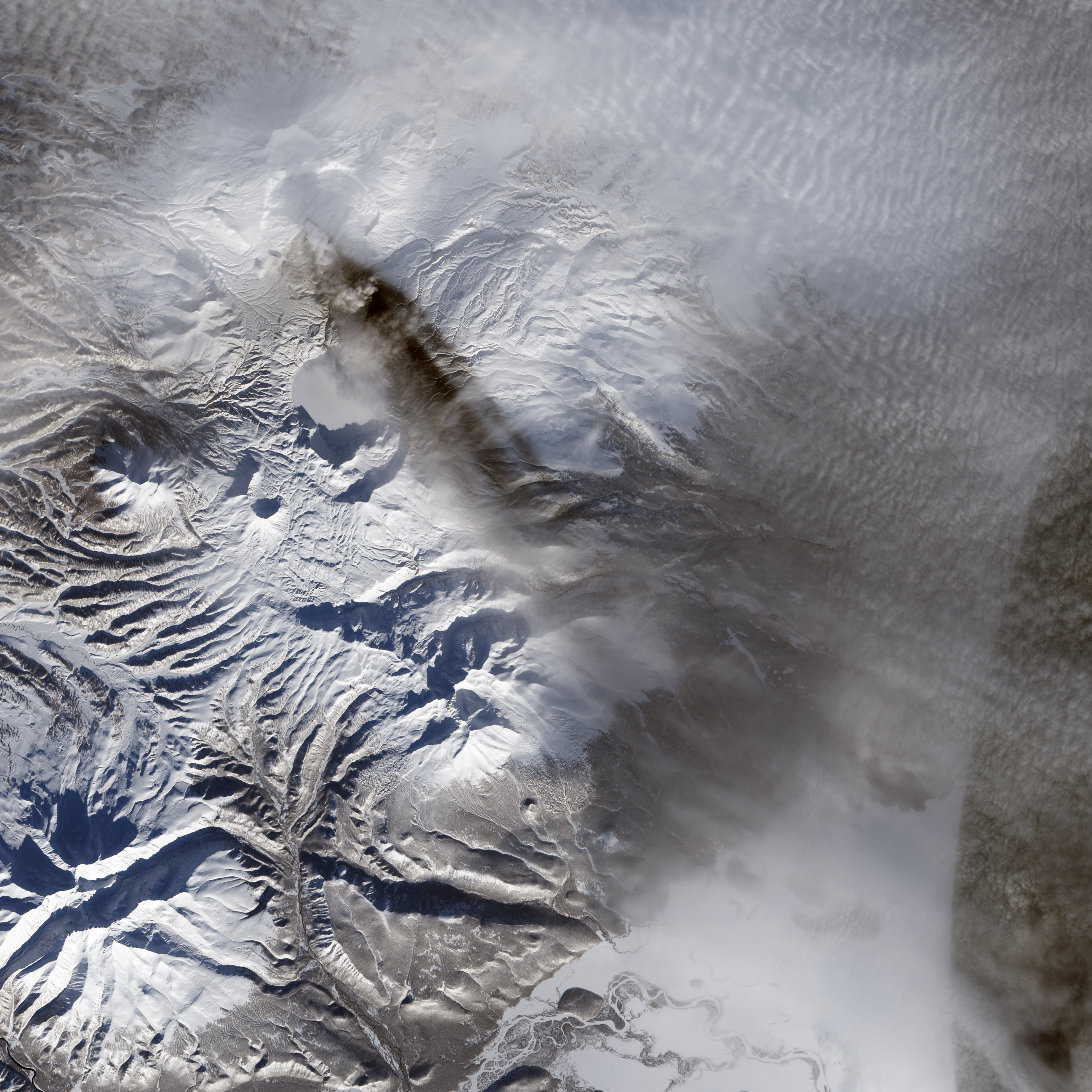
Karymsky is one of the most active volcanoes on Russia’s Kamchatka Peninsula. Evidence of its frequent eruptions is visible in this natural-color satellite image. A streak of dark ash extends southeast from Karymsky’s summit amidst a backdrop of snow. The image was acquired by the Operational Land Imager (OLI) aboard the Landsat 8 satellite on January 18, 2015.
References
- Global Volcanism Program (2011, May 4) Weekly Volcanic Activity Reports, Karymsky. Accessed January 23, 2015.
- Kamchatka Volcanic Eruption Response Team (2011, May 5) KVERT Information Releases. Accessed January 23, 2015.
- NASA Earth Observatory (2014, September 25) Volcanoes of Kamchatka.
NASA Earth Observatory image by Jesse Allen, using Landsat data from the U.S. Geological Survey.
This image record originally appeared on the Earth Observatory. Click here to view the full, original record.