
Plumes from Pavlof Volcano
Downloads
- pavlof_oli_2014319_lrg.jpg (3600x2400, JPEG)
- pavlof_oli_2014319_geo.tif (GeoTIFF)
- pavlof_amo_2014319_lrg.jpg (2400x1800, JPEG)
- pavlof_amo_2014319_geo.tif (GeoTIFF)
Metadata
- Sensor(s):
- Landsat 8 - OLI
- Aqua - MODIS
- Data Date: November 15, 2014
- Visualization Date: November 17, 2014
In November 2014, Alaska’s most active volcano rumbled back to life. The Alaska Volcano Observatory first reported increased seismic activity and minor ash eruptions at Pavlof on November 12, 2014. In the following days, lava fountains gushed from a vent north of the summit, and volcanic debris tumbled down the glacier-covered stratovolcano’s north flank.
By November 15, Pavlof was lofting ash plumes to an altitude of 30,000 feet (9 kilometers), high enough to disrupt commercial airline flights. Seismic activity and ash eruptions diminished abruptly on the evening of November 16, but the Alaska Volcano Observatory cautioned that pauses of days to weeks are common during Pavlof’s eruptions. The volcano could spew ash again with little warning.
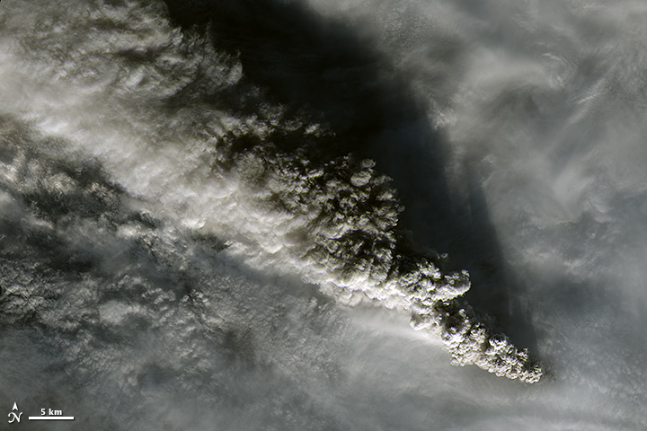
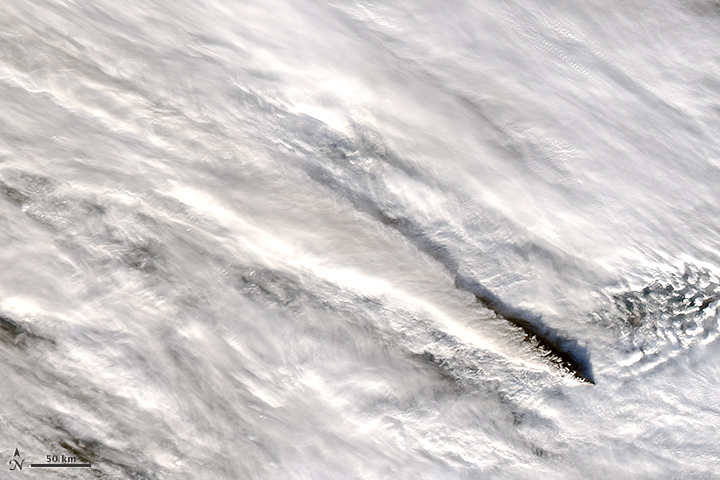
This natural-color satellite image, acquired by the Operational Land Imager (OLI) on the Landsat 8 satellite, shows Pavlof’s volcanic plume well above the cloud deck on November 15, 2014. On the same day, the Moderate Resolution Imaging Spectroradiometer (MODIS) on NASA’s Aqua satellite captured a broader view of the plume.
Pavlof’s most recent significant eruption occurred in May 2013.
References
- Alaska Volcano Observatory (2014, November 17) Daily Update. Accessed November 17, 2014.
- Eruptions Blog via Wired (2014, November 16) Pavlof Eruption Intensifies, Ash Reaching over 30,000 Feet. Accessed November 17, 2014.
- McNutt, S. R., et al, (1991, February) Geological and seismological evidence of increased explosivity during the 1986 eruptions of Pavlof volcano, Alaska. Bulletin of Volcanology, 53 (2), 86-98.
Related Reading
- Alaska Volcano Observatory
- Pavlof Volcano description and information
NASA Earth Observatory image by Jesse Allen, using Landsat data from the U.S. Geological Survey and MODIS data from LANCE MODIS Rapid Response Team. Caption by Adam Voiland.
This image record originally appeared on the Earth Observatory. Click here to view the full, original record.