acquired July 4, 2014
Growth of Nishino-shima Volcanic Island
Downloads
- nishinoshima_oli_2014185_lrg.jpg (5124x3416, JPEG)
- nishinoshima_oli_2014185_geo.tif (GeoTIFF)
Metadata
- Sensor(s):
- Landsat 8 - OLI
- Data Date: July 4, 2014
- Visualization Date: July 16, 2014
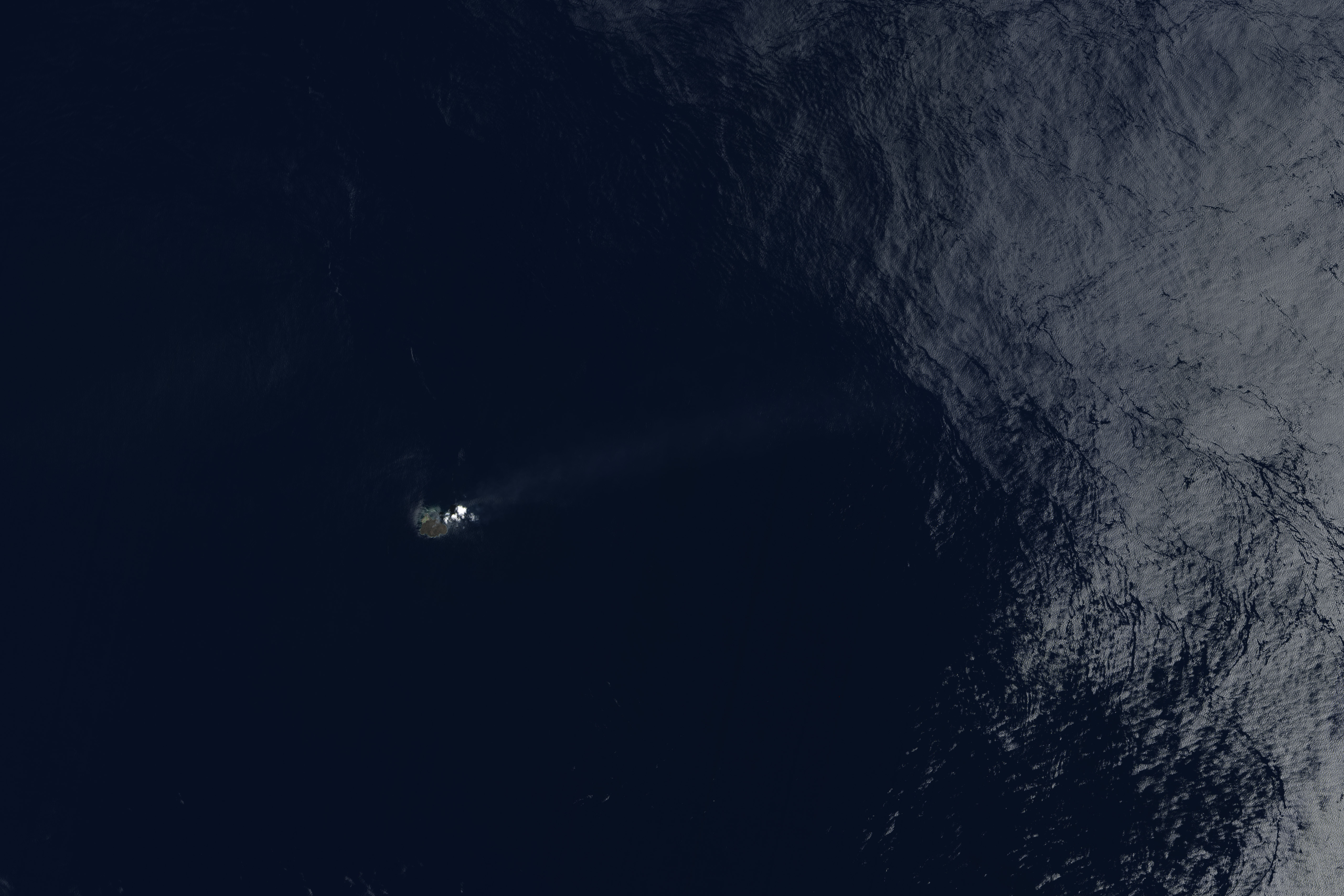
More than 6 months after it broke the surface of the Pacific Ocean, Nishino-shima (once called Niijima) continues to grow. The new land surface is now several times larger than original Nishino-shima, which formed in 1973–74. The islets merged in December 2013.
This natural-color image was collected by the Operational Land Imager (OLI) on Landsat 8 on July 4, 2014. It shows a plume of ash, steam, and other volcanic gases streaming from a crater in the center of the island.
NASA Earth Observatory image by Jesse Allen and Robert Simmon, using Landsat data from the USGS Earth Explorer. Caption by Robert Simmon.
This image record originally appeared on the Earth Observatory. Click here to view the full, original record.