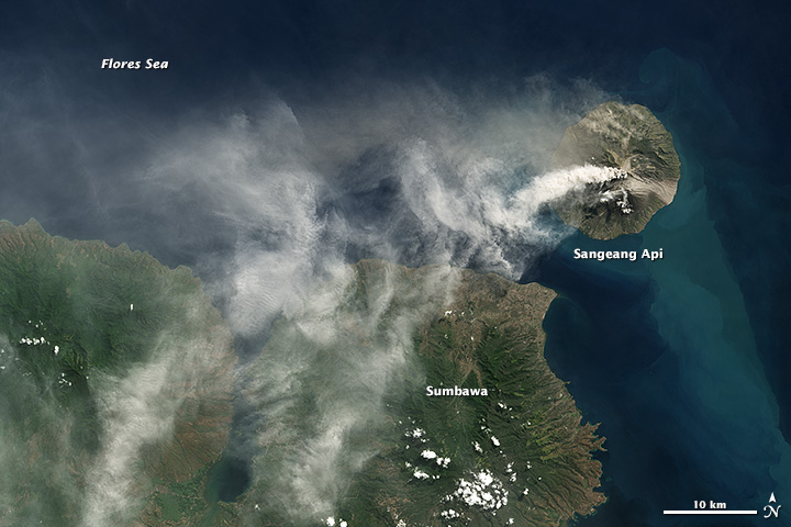
acquired June 1, 2014
Sangeang Api Eruption
Downloads
- sangeang_oli_2014152_lrg.jpg (5634x3755, JPEG)
- sangeang_oli_2014152_geo.tif (GeoTIFF)
Metadata
- Sensor(s):
- Landsat 8 - OLI
- Data Date: June 1, 2014
- Visualization Date: June 19, 2014
Sangeang Api, an island volcano just of the coast of Sumbawa Island, Indonesia, began a series of large eruptions on May 30, 2014. Landsat 8 collected this true-color image of an ash plume rising from the volcano on June 1, 2014.
NASA Earth Observatory images by Robert Simmon, using Landsat 8 data from the USGS Earth Explorer.
This image record originally appeared on the Earth Observatory. Click here to view the full, original record.