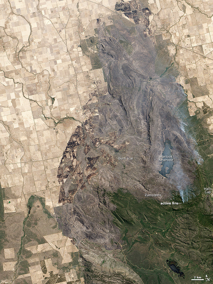
acquired January 19, 2014
Grampians Fire, Australia
Downloads
- grampians_oli_2014019_lrg.jpg (4800x4800, JPEG)
- grampians_oli_2014019_geo.tif (GeoTIFF)
- grampians_oli_2014019_swir_lrg.jpg (2400x2400, JPEG)
- grampians_oli_2014019_swir_geo.tif (GeoTIFF)
Metadata
- Sensor(s):
- Landsat 8 - OLI
- Data Date: January 19, 2014
- Visualization Date: January 23, 2014
A large fire burning in and around Grampians National Park in Victoria, Australia, was nearly contained when the Operational Land Imager on the Landsat 8 satellite acquired this image on January 19, 2014. The burned land is gray-brown in this natural-color image. Active fires were burning on the east side of the burn area, sending up plumes of smoke.
Related Reading
- ABC News (2014, January 17) One dead as bushfires burn across Victoria, South Australia, heatwave continues. Accessed January 22, 2014.
- The Border Mail (2014, January 21) Twenty-seven homes lost in Grampions fire. Accessed January 22, 2014.
NASA Earth Observatory image by Jesse Allen and Robert Simmon, using Landsat data from the U.S. Geological Survey. Caption by Holli Riebeek.
This image record originally appeared on the Earth Observatory. Click here to view the full, original record.