acquired June 14, 2007
Cedar River Rises
Downloads
- 2008_Cedar_Rapids2.tif (TIFF)
Metadata
- Sensor(s):
- Landsat 5 - TM
- Data Date: June 14, 2007
- Visualization Date: May 22, 2012
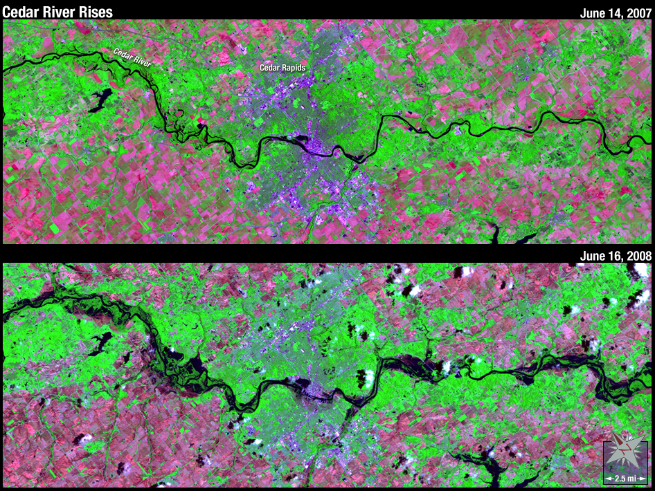
In June of 2008 Cedar Rapids, Iowa, was severely flooded when heavy rains coupled with melting snow creating a 500-year flood event. The swollen Cedar River winds through a false-color Landsat 5 image (bottom) acquired on June 16, 2008. The city of Cedar Rapids is the bright spot adjacent to the river in the image center. At its peak, the flood inundated 14 percent of Cedar Rapids.
NASA GSFC Landsat/LDCM EPO Team