acquired November 7, 2004 - September 7, 2005
Katrina’s Deluge
Downloads
- 2005_Katrina_before.tif (TIFF)
- 2005_Katrina_after.tif (TIFF)
Metadata
- Sensor(s):
- Landsat 5 - TM
- Data Date: November 7, 2004 - September 7, 2005
- Visualization Date: May 21, 2012
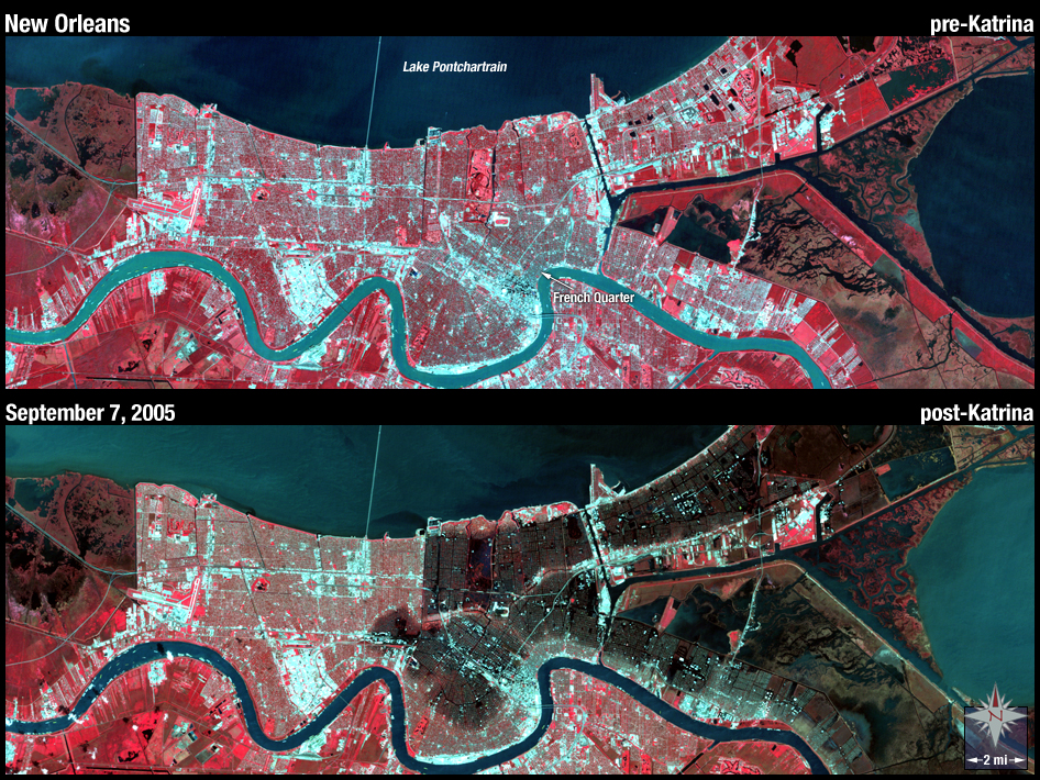
Two weeks after Hurricane Katrina made landfall in 2005, Landsat 5 captured the image on the bottom of flooded New Orleans. In these false-color image, vegetation appears red and man-made structures appear whitish blue.
NASA GSFC Landsat/LDCM EPO Team