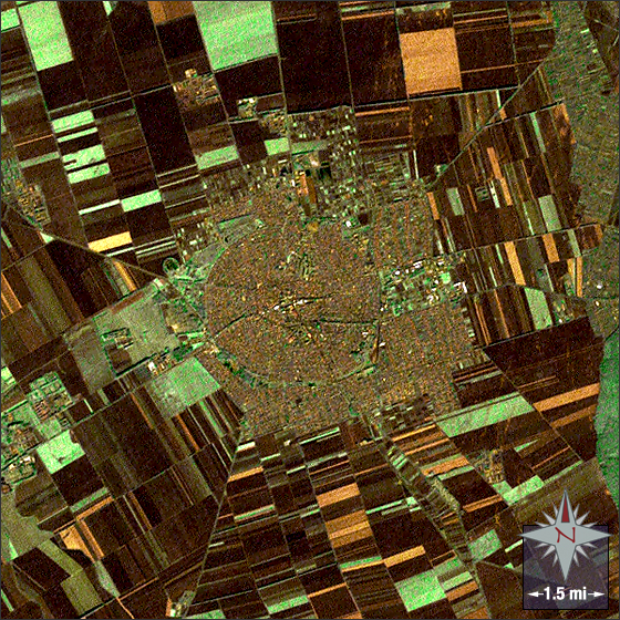
Hajdúböszörmény, Hungary
Downloads
Metadata
- Sensor(s):
- Landsat 7 - ETM+
- Data Date: August 24, 2000
- Visualization Date: December 27, 2011
Hajdúböszörmény has a population of approximately 30,000 and lies in North Eastern Hungary. The unique circular street layout of Hajdúböszörmény was originally meant to befuddle potential invaders or attackers.
In this image Hajdúböszörmény is the swirl of brown, green and white in the center. Vegetation is green and fields are brown and tan.
This Landsat 7 image was acquired August 30, 2000. It is a true color pan-sharpened image using ETM+ bands 3, 2, 1 and the panchromatic band. The addition of the panchromatic band sharpens the spatial resolution of the image (to 15m/pixel), but can effect the color quality; notice that the greens looks somewhat “minty†and the city appears more “brown†than it would without the pan-sharpening process. Hajdúböszörmény falls on Landsat WRS-2 Path 186 Row 27.
NASA GSFC Landsat/LDCM EPO Team