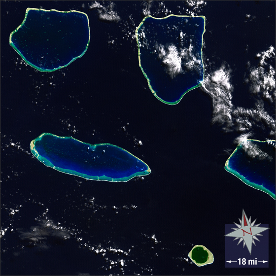
Five Islands of French Polynesia
Downloads
Metadata
- Sensor(s):
- Landsat 7 - ETM+
- Data Date: May 14, 2000
- Visualization Date: December 21, 2011
French Polynesia is made up of six island groups located in the middle of the Pacific Ocean to the East of Australia and the West of South America. French Polynesia was officially united in 1889 with the establishment of the French Protectorate. Today it is a constituent country of the French Republic. French Polynesia is made up of approximately 130 islands and has a population of approximately 267,000 people.
Shown here are five islands/atolls of French Polynesia. These islands are part of French Polynesia’s Tuamotu Archipelago—the largest chain of atolls in the world. Ferdinand Magellan discovered the archipelago in 1521. Since then, its sudden shallows have been the cause of countless shipwrecks.
In this image, both sand and bare ground appear tan, small patches of vegetation on the outer rings of the atolls appear green. Deep ocean is dark blue while shallower waters inside the atolls are lighter shades of blue. The lagoon waters of Niau appear greenish; this may be due to the hypersaline water of the completely enclosed lagoon. Clouds are white.
This Landsat 7 image was acquired May 14, 2000. It is a false color pan-sharpened image using ETM+ bands 3, 2, 1 and the panchromatic band. These islands fall on Landsat WRS-2 Path52 Row 71.
NASA GSFC Landsat/LDCM EPO Team