acquired April 22, 2000
Etosha pan
Downloads
Metadata
- Sensor(s):
- Landsat 7 - ETM+
- Data Date: April 22, 2000
- Visualization Date: December 21, 2011
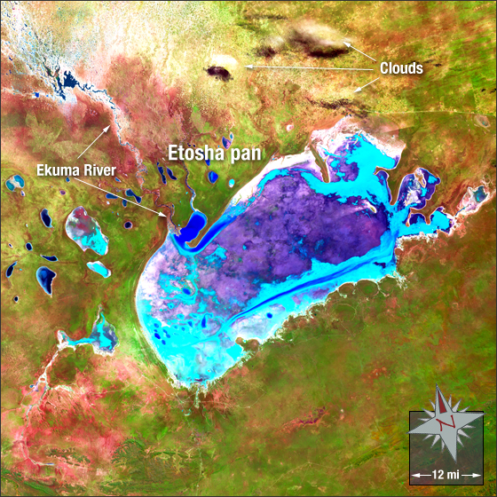
In north Namibia, the Etosha pan—a 75-mile long dry lakebed—makes up part of the Namib Desert. The Etosha salt pan is mostly made up of dry mud and salt. The Ekuma River is the salt pan’s sole source of water.
In this image the Etosha pan is blue, violet, cyan and white. Vegetation is green and bare ground appears brown, pink and red. Clouds are white.
This Landsat 7 image was acquired April 22, 2000. It is a false color image using ETM+ bands 7,4, and 2. The Etosha pan falls on Landsat WRS-2 Path 179 Row 73.
NASA GSFC Landsat/LDCM EPO Team