acquired November 14, 2010
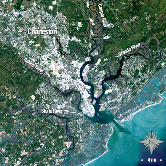
Charleston, South Carolina
Downloads
Metadata
- Sensor(s):
- Landsat 5 - TM
- Data Date: November 14, 2010
- Visualization Date: December 21, 2011
Charleston, South Carolina is a historical city located on the state’s southeastern coast. English settlers established Charleston in 1670 under the leadership of William Sayle. It was originally named Charles Towne after England’s King Charles II. Today it is the second most populated city in South Carolina with a population of 124,593.
In this image Charleston is white and gray, vegetation is green, water is blue and marshy areas are a brownish purple.
This Landsat 5 image was acquired November 14, 2010. It is a true color image using TM bands 3, 2, and 1. Charleston falls on Landsat WRS-2 Path 16 Row 37.
NASA GSFC Landsat/LDCM EPO Team