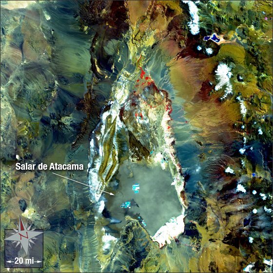
acquired March 21, 2002
Salar de Atacama
Downloads
- Atacama_Desert_432crop.tif (TIFF)
Metadata
- Sensor(s):
- Landsat 7 - ETM+
- Data Date: March 21, 2002
- Visualization Date: December 21, 2011
Salar de Atacama is the largest salt flat in Chile and the world’s second largest salt flat. It is also the planet’s largest and purest active source of lithium. Salar de Atacama is located in northeastern Chile.
In this image the Salt Pan is mostly a grey-green with some white and cyan. Bare ground and rock range from tan and brown to green and dark grey. Snow is white and vegetation is red.
This Landsat 7 image was acquired March 21, 2002. It is a false color image using ETM+ bands 4,3, 2 and the panchromatic band. Salar de Atacama falls on Landsat WRS-2 Path 233 Row 76.
NASA GSFC Landsat/LDCM EPO Team