
Morganza Floodway
Downloads
- morganza_tm5_2011162_lrg.jpg (3600x6000, JPEG)
- morganza_tm5_2011162_crop_geo.tif (3600x6000, GeoTIFF)
- morganza_tm5_2008170_lrg.jpg (3600x6000, JPEG)
- morganza_tm5_2008170_crop_geo.tif (3600x6000, GeoTIFF)
Metadata
- Sensor(s):
- Landsat 5 - TM
- Data Date: June 11, 2011
- Visualization Date: June 13, 2011
Water levels were slowly receding along the Mississippi and Atchafalaya Rivers in Louisiana in June 2011. Although the Advanced Hydrological Prediction Service reported flooding at several locations in the Baton Rouge area, flood levels were moderate and river levels were projected to continue falling over the next few days.
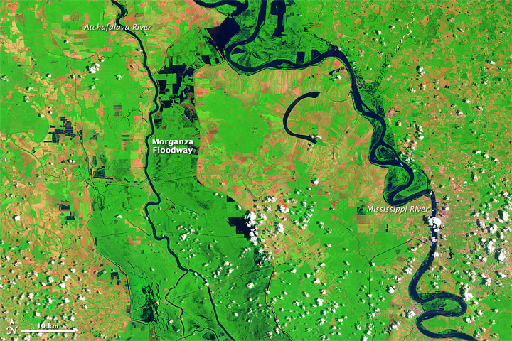
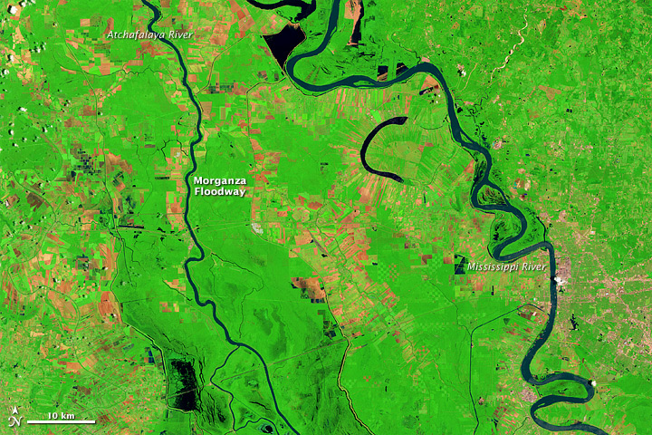
The Thematic Mapper on the Landsat 5 satellite captured these images on June 11, 2011 (top), and June 18, 2008 (bottom). In these false-color images, water is navy blue. Depending on land use, areas above water are green or burnt orange. Clouds floating overhead are nearly white and cast shadows.
The June 2011 image shows flooding along the Mississippi River and water in the Morganza Floodway. The U.S. Army Corps of Engineers opened the floodway in May 2011 to divert excess flood waters from the Mississippi River to the Atchafalaya Basin.
Much of the land in and around the Atchafalaya Basin is devoted to agriculture, as the rectangular shapes of varying colors indicate.
-
References
- National Weather Service. Advanced Hydrologic Prediction Service. Accessed June 14, 2011.
NASA Earth Observatory image created by Jesse Allen, using Landsat data provided by the United States Geological Survey. Caption by Michon Scott.
This image record originally appeared on the Earth Observatory. Click here to view the full, original record.