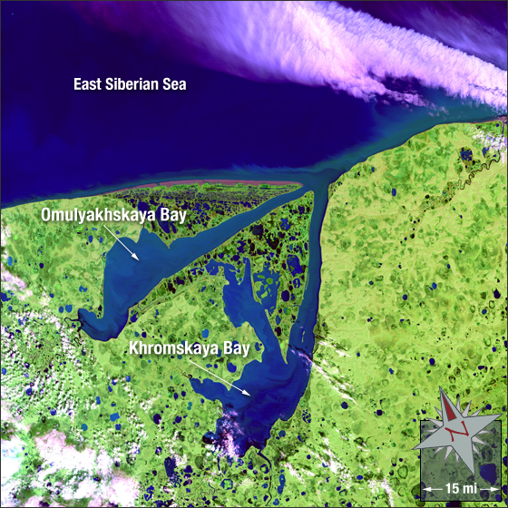
Khromskaya and Omulyakhskaya Bays
Downloads
- Khromskaya_Bay.tif (5815x5815, TIFF)
Metadata
- Sensor(s):
- Landsat 5 - TM
- Data Date: July 27, 2008
- Visualization Date: March 9, 2011
The Khromskaya and Omulyakhskaya Bays are located in northeastern Russia. Both bays share the same mouth which connects them to the East Siberian Sea. Lakes and marshes dot the landscape surrounding the two large bays. The Khromskaya Bay is approximately 80 miles in length by 19 miles in width. The Omulyakhskaya Bay is approximately 71 miles in length by 16 miles in width. The bays are covered in ice most of the year due to their northerly location.
In this summer image water is blue (and ice-free), vegetation is green, bare ground is a muddy red, and clouds are white with light shades of purple.
This Landsat 5 image was acquired July 27, 2008. It is a false color image using TM bands 7,4 and 2. The bays fall on Landsat WRS-2 Path 118 Row 9.
NASA GSFC Landsat/LDCM EPO Team