Lake District, England
Downloads
- Lakeland.tif (4717x4717, TIFF)
Metadata
- Sensor(s):
- Landsat 5 - TM
- Data Date: July 19, 2006
- Visualization Date: March 9, 2011
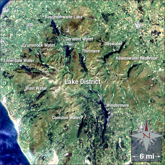
The Lake District is a mountainous region in northwest England. It derives its name from the many bodies of water scattered around the Cumbrian Mountains. There are 14 main bodies of water but only one official lake: Bassenthwaite Lake. The other bodies of water are referred to as “meres,†“waters,†“tarns,†or “reservoirs.†The lakes were formed approximately two million years ago when glaciers carved out deep valleys, which over time filled in with meltwater and rain.
In this image the water is blue/dark blue, bare ground is yellow and tan, vegetation is green, and developed areas are grey.
This Landsat 5 image was acquired July 19, 2006. The image was created using TM bands 3, 2, and 1. The Lake District falls on Path 204 Row 22.
NASA GSFC Landsat/LDCM EPO Team