acquired March 21, 2003
Kebira Crater
Downloads
- Kebira_Crater.tif (1285x1285, TIFF)
Metadata
- Sensor(s):
- Landsat 7 - ETM+
- Data Date: March 21, 2003
- Visualization Date: January 4, 2011
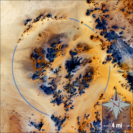
The Kebira Crater is the name proposed for a circular topographic feature found in the Sahara desert. The feature lies mainly in Libya with the eastern edge protruding into Egypt. Dr. Farouk El-Baz and Dr. Eman Ghoneim found the proposed impact crater using satellite imagery in March 2006.
In this image the proposed crater boarder is marked with a blue line, bare ground is yellow, brown, orange and tan, and rock is black and dark blue.
This Landsat 7 image was acquired March 21, 2003. The image was created using ETM+ bands 3, 2, and 1. Kebira Crater falls on Landsat WRS-2 Path 180 Row 43.
NASA GSFC Landsat/LDCM EPO Team