Sivash, Ukraine
Downloads
- Sivash.tif (3904x2858, TIFF)
Metadata
- Sensor(s):
- Landsat 5 - TM
- Data Date: September 3, 2009
- Visualization Date: November 17, 2010
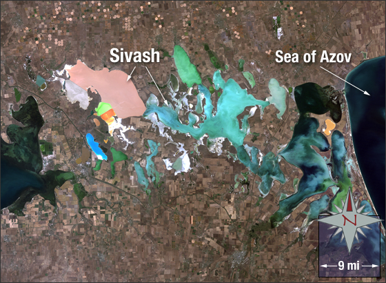
Sivash, aka the “Rotten Sea,†is a system of shallow lagoons with a maximum depth of approximately three meters. The lagoon bottoms are covered with five meters of silt. Sivash is called the “Rotten Sea†due to the rotten smell emanating from it when the water heats up during the summer months. Sivash is located on the northeastern coast of the Crimean Peninsula in Ukraine and on the west coast of the Sea of Azov.
In this image bare ground is brown and tan, vegetation is green, buildings are grey and water is blue, green, orange, and a light tan. The shallowness and composition of the lagoons create the abnormal water coloration seen in this image.
This Landsat 5 image was acquired September 3, 2009. The image was created using TM bands 3,2 and 1. Sivash falls on Landsat WRS-2 Path 177 Row 28.
NASA GSFC Landsat/LDCM EPO Team