acquired June 22, 2000
Semisopochnoi Island
Downloads
- Semisopochnoi.tif (7215x7215, TIFF)
Metadata
- Sensor(s):
- Landsat 7 - ETM+
- Data Date: June 22, 2000
- Visualization Date: November 17, 2010
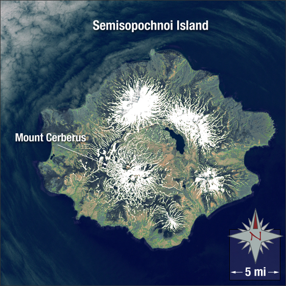
Alaska’s Semisopochnoi Island (which in Russian means “having seven hills”) is located in the western Aleutian Islands and is part of the Rat Islands group. At longitude 179°37’ East, Semisopochnoi is arguably the most eastern point of land in the United States and North America.
In this image snow is white, bare ground is tan, water is blue, clouds are grey, and vegetation is green.
This Landsat 7 image was acquired on June 22, 2000. It is a pseudo-true color image using ETM+ bands 3, 2, 1, and the panchromatic band. Semisopochnoi Island falls on Landsat WRS-2 Path 85 Row 24.
NASA GSFC Landsat/LDCM EPO Team