acquired April 5, 2000
Tassili n’Ajjer
Downloads
- tassili.tif (14000x10723, TIFF)
Metadata
- Sensor(s):
- Landsat 5 - TM
- Data Date: April 5, 2000
- Visualization Date: September 16, 2010
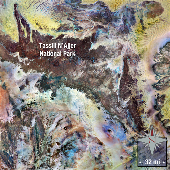
Tassili n’Ajjer, also known as the Plateau of the Rivers, is a mountain range in the Sahara Desert. It is approximately 310 miles at its longest and is located in southeast Algeria, North Africa. The highest peak is Adrar Afao at approximately 7,128 feet.
In this image sand is yellow and tan and mountains are brick red.
This Landsat mosaic image was acquired in the year 2000. It is a false-colored image using bands 7, 4, and 2. Tassili n’Ajjer falls on Landsat WRS-2 Path 190 Row 42.
NASA GSFC Landsat/LDCM EPO Team