acquired September 11, 2000
Tao-Rusyr Caldera
Downloads
- Tao_Rusyr_Caldera _321p.tif (2100x2100, TIFF)
Metadata
- Sensor(s):
- Landsat 7 - ETM+
- Data Date: September 11, 2000
- Visualization Date: September 16, 2010
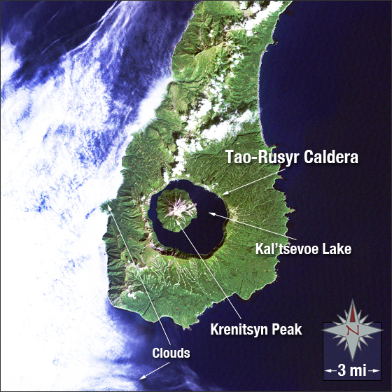
The Tao-Rusyr Caldera is located on the southern end of Onekotan Island. The island is part of the 56 Kuril Islands in Russia between the Sea of Okhotsk and the Pacific Ocean. The Caldera is approximately 4.7 miles wide and filled with the waters of the Kal’tsevoe Lake. In 1952 the volcano erupted forming Krenitsyn Peak inside Kal’tsevoe Lake.
In this image vegetation is green, clouds are white, water is blue and bare ground is brown.
This Landsat 7 image was acquired on September 11, 2000. It is a true color image using ETM+ bands 3, 2, and 1. The Tao-Rusyr Caldera falls on Landsat WRS-2 Path 101 Row 26.
NASA GSFC Landsat/LDCM EPO Team