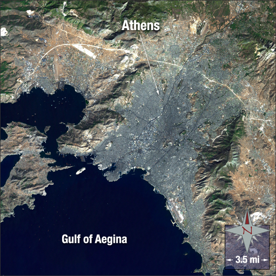
acquired October 14, 2001
Athens, Greece
Downloads
- Athens_Greece.tif (3965x3965, TIFF)
Metadata
- Sensor(s):
- Landsat 7 - ETM+
- Data Date: October 14, 2001
- Visualization Date: July 14, 2010
Athens, Greece began its history in the Neolithic period and later became known as the cradle of western civilization. It’s the capital and largest city of Greece with a population of 745,513. Athens is located in the south of Greece across the central plane of the Attica Basin.
In this image you can see Athens in grey surrounded by vegetation in green and bare ground in brown. The Gulf of Aegina, part of the Aegean Sea, is dark blue.
This Landsat 7 image was acquired on October 14, 2001. It is a true color image using ETM+ bands 3, 2, 1, and panchromatic band. Athens falls on Landsat WRS-2 Path 183 Row 34.
NASA GSFC Landsat/LDCM EPO Team