acquired June 18, 2009
Bangweulu System
Downloads
- Bangweulu.tif (5937x5937, TIFF)
Metadata
- Sensor(s):
- Landsat 5 - TM
- Data Date: June 18, 2009
- Visualization Date: May 19, 2010
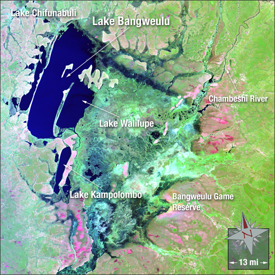
The Bangweulu wetland system, which covers an area roughly the size of Connecticut, encompasses Lake Bangweulu, the Bangweulu Swamps, and the Bangweulu Floodplain. It is located in the upper Congo River basin in Zambia. Seventeen rivers feed the massive Bangweulu system. Its primary inflow is the Chambeshi River to the northeast and its primary outflow is the Luapula River to the south.
In this image green represents vegetation, blue represents water, and magenta represents bare ground.
This Landsat 5 image was acquired on June 18, 2009. It is a false color image using TM bands 7, 4, and 2. Bangweulu falls on Landsat WRS-2 Path 171 Row 68.
NASA GSFC Landsat/LDCM EPO Team