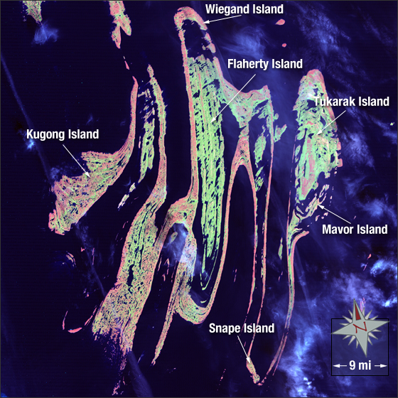
acquired December 2006
Belcher Islands
Downloads
- Belcher_Islands.tif (8401x7581, TIFF)
Metadata
- Sensor(s):
- Landsat 7 - ETM+
- Data Date:
- Visualization Date: May 19, 2010
The Belcher Islands, which were named after the British Admiral Sir Edward Belcher (1799-1877), are located in Hudson Bay, Nunavut/Canada. There are 1,500 islands in this archipelago containing a total of 1,160 square miles of land. In this image six major islands are displayed, including Weigand, Kugong, Flaherty, Tukarak, Mavor, and Snape islands. Vegetation appears light green, water is blue, clouds are light blue/white, and bare ground is pink.
This Landsat 7 image was acquired in 2006. It is a false color image using ETM+ bands 7, 4, and 2. The Belcher Islands fall on Landsat WRS-2 Path 21 Row 21.
NASA GSFC Landsat/LDCM EPO Team