acquired May 9, 2005
Washington, DC
Downloads
- Washington_DC.tif (4165x4165, TIFF)
Metadata
- Sensor(s):
- Landsat 7 - ETM+
- Data Date: May 9, 2005
- Visualization Date: February 18, 2010
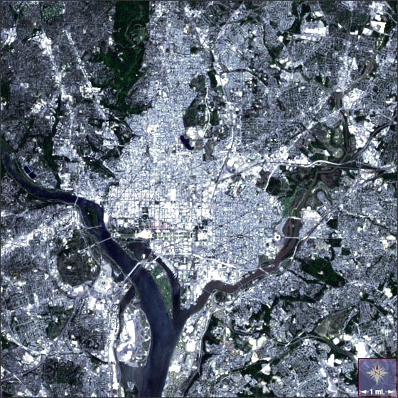
Our nation's capital sits at the confluence of the Potomac and Anacostia Rivers. At the top left of this image the dark green of Rock Creek Park's forest stands out against the white of urban structures.
This Landsat 7 image of Washington, D.C. was acquired on May 9, 2005. This is a natural-color image using ETM+ bands 3, 2, and 1. DC falls on Landsat WRS-2 Path 15 Row 33.
NASA GSFC Landsat/LDCM EPO Team