acquired July 18, 2007
Peloponnesus Peninsula, Greece - Fire Scars
Downloads
- Greek_Fires.tif (5769x2476, TIFF)
Metadata
- Sensor(s):
- Landsat 7 - ETM+
- Data Date: July 18, 2007
- Visualization Date: February 18, 2010
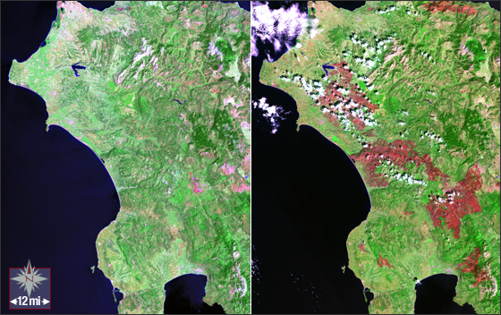
On the Peloponnesus Peninsula in southwestern Greece, severe wildfires burned large tracts of land late this summer (2007). Many satellite images, including Landsat images, were used to create fire maps for disaster response teams.
The Landsat 7 images above (WRS-2 Path 184 Row 34) are a composites of ETM+ bands 7, 4, and 2. Gaps in these SLC-off images were filled using the Level 1T Segment-based gap-fill method. This image was provided courtesy of USGS.
NASA GSFC Landsat/LDCM EPO Team