acquired September 16, 2000
EyjabakkajÖkull glacier, Iceland
Downloads
- Eyj_Iceland.tif (4707x4707, TIFF)
Metadata
- Sensor(s):
- Landsat 7 - ETM+
- Data Date: September 16, 2000
- Visualization Date: January 5, 2010
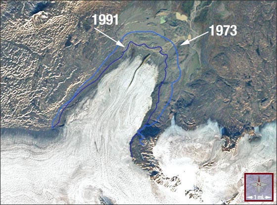
Eyjabakkajökull is an outlet glacier of the Vatnajökull ice cap in Iceland. It has been retreating since a 2.8-km surge occurred in 1972-1973. This true-color Landsat 7 image shows the glacier terminus in September 2000, by which time it had retreated 1.8 km. The light- and dark-blue outlines show the terminus extent in 1973 and 1991, respectively.
About the image: Landsat 7 ETM+ natural-color composite (bands 3, 2, 1) with outlines derived by D.K. Hall, R.S. Williams, Jr. and O. Sigurðsson, from Landsat 1 MSS and Landsat 5 TM data. Image processing by Marit Jentoft-Nilsen of NASA's Visualization Analysis Lab.
NASA GSFC Landsat/LDCM EPO Team