acquired July 30, 2006
Garig Gunak Barlu National Park
Downloads
- Garig_Gunak_Barlu.tif (5195x5195, TIFF)
Metadata
- Sensor(s):
- Landsat 5 - TM
- Data Date: July 30, 2006
- Visualization Date: January 5, 2010
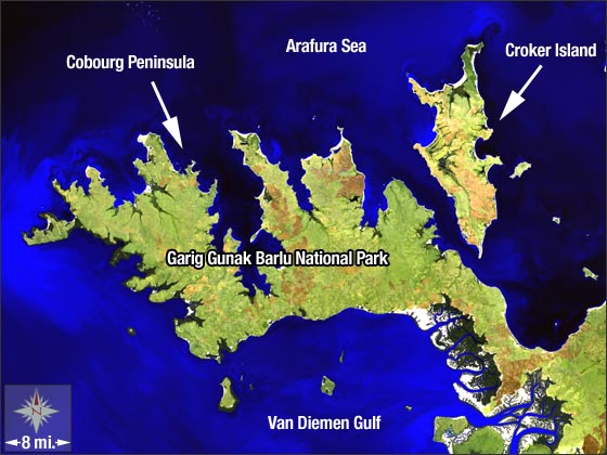
Garig Gunak Barlu National Park is found in the northernmost reaches of Australia's Northern Territory on the Cobourg Peninsula and is part of Arnhem Land, a 91,000 km² tract of Aboriginal land. The park encompasses the entire Cobourg Peninsula as well as the surrounding waters of Van Diemen Gulf and the Arafura Sea.
This Landsat 5 image was acquired on July 30, 2006. This false-color image, is a composite of TM bands 7, 5, 2. Garig Gunak Barlu National Park is found on Landsat WRS-2 Path 105 Row 68.
NASA GSFC Landsat/LDCM EPO Team