Glacier Bay
Downloads
- Glacier_Bay.tif (8641x7861, TIFF)
Metadata
- Sensor(s):
- Landsat 7 - ETM+
- Data Date: August 1, 1999
- Visualization Date: December 28, 2009
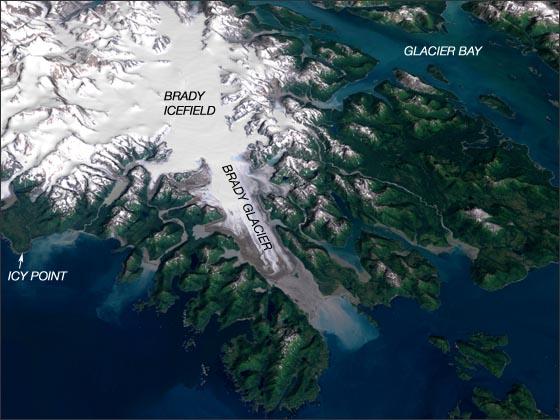
Glacier Bay National Park and Preserve, located in southeast Alaska, can only be reached by plane or boat. It was by boat that Captain George Vancouver first charted this region in 1794. At that time, Glacier Bay was covered by a massive glacier extending 100 miles to the north, 20 miles across and more than 4,000 feet high in some places.
Today, as the glaciers that flow into Glacier Bay continue to retreat, the region is being observed by scientists who seek to understand the isostatic rebound effects associated with rapid deglaciation. Such research will also be part of the International Polar Year (IPY) activities.
The perspective image above uses Landsat 7 data collected on August 1, 1999 combined with elevation data from the USGS National Elevation Dataset (NED). The natural-color Landsat image uses ETM+ bands 3, 2, and 1. There is no vertical exaggeration.
NASA GSFC Landsat/LDCM EPO Team