acquired January 20, 2002
Abadan, Iran
Downloads
- Abadan_742p.tif (8241x7261, TIFF)
Metadata
- Sensor(s):
- Landsat 7 - ETM+
- Data Date: January 20, 2002
- Visualization Date: December 22, 2009
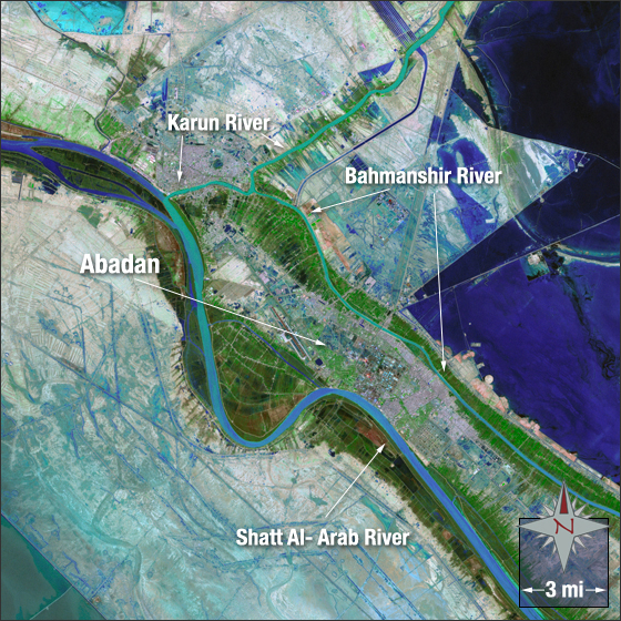
Abadan is a city in southwestern Iran thought to have been founded in the 8th century by a holy man named Abbad. The city lies between two rivers—the Shatt al-Arab (or Arvand River) to the west and the Bahmanshir River to the east. In this image you can see Abadan in light purple and grey surrounded by vegetation in green. Bare ground is shown in brown and water in blue.
This Landsat 7 image was acquired on January 20, 2002. It is a false color image using ETM+ bands 7, 4, 2, and panchromatic band. Abadan falls on Landsat WRS-2 Path 165 Row 39.
NASA GSFC Landsat/LDCM EPO Team