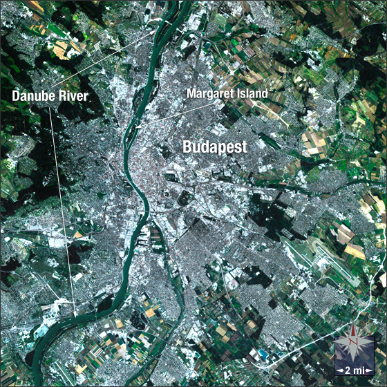
acquired July 19, 2006
Budapest, Hungary
Downloads
- Budapest.tif (1317x1317, TIFF)
Metadata
- Sensor(s):
- Landsat 5 - TM
- Data Date: July 19, 2006
- Visualization Date: November 23, 2009
Budapest is the largest city and capital of Hungary with approximately 1.7 million people. It is located in the mid-northern section of Hungary and is divided from North to South by the Danube River. The river acts as a natural barrier dividing the city into Buda and Pest, Buda being on the western hilly side and Pest on the eastern plains side.
In this image Budapest appears grey in color and is surrounded by green and beige fields. The blue Danube River can be seen meandering through the city.
This Landsat 5 image was acquired on July 19, 2006. It is a natural-color image using TM bands 3, 2, and 1. Budapest falls on Landsat WRS-2 Path 188 Row 27.
NASA GSFC Landsat/LDCM EPO Team