acquired June 29, 2002
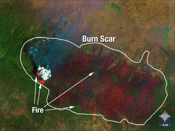
Rodeo-Chediski Fire
Downloads
- Mogollon_Rim_fire.tif (1600x1200, TIFF)
Metadata
- Sensor(s):
- Landsat 5 - TM
- Data Date: June 29, 2002
- Visualization Date: October 19, 2009
In June 2002, the Rodeo-Chediski Fire burned nearly 500,000 acres in eastern Arizona, making it the worst wild fire in the state’s history. This false-color Landsat 5 image, acquired on June 29, shows the active fire front and the massive burn scar created by the blaze.
NASA GSFC Landsat/LDCM EPO Team