acquired May 17, 1998
Birmingham, AL
Downloads
- Birmingham_Tornado.tif (1600x1200, TIFF)
Metadata
- Sensor(s):
- Landsat 5 - TM
- Data Date: May 17, 1998
- Visualization Date: October 16, 2009
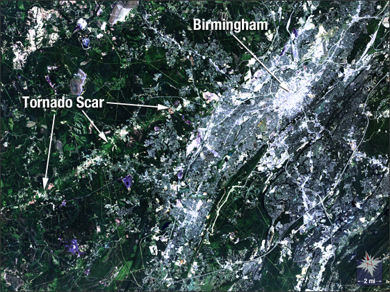
In this 1998 natural-color Landsat 5 image, the city of Birmingham, Ala., is shown a month after a category F5 tornado ripped through the region, killing 32 people. A portion of the 31-mile tornado track can be seen as a light green line stretching southwest away from the city.
NASA GSFC Landsat/LDCM EPO Team