acquired October 16, 1995
Pensacola, FL
Downloads
- Hurricane_Opal.tif (1600x1200, TIFF)
Metadata
- Sensor(s):
- Landsat 5 - TM
- Data Date: October 16, 1995
- Visualization Date: October 16, 2009
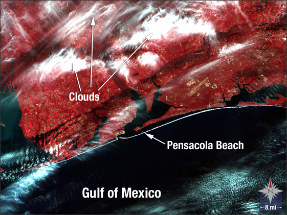
This false-color infrared image shows the eastern panhandle of Florida about 12 days after the Category 4 Hurricane Opal made landfall near Pensacola. The hurricane season of 1995 was abnormally active, with 19 named storms and 11 hurricanes, five of which reached "major" intensity.
NASA GSFC Landsat/LDCM EPO Team