acquired July 17, 2000
Inverness, Scotland
Downloads
- Inverness.tif (1846x1846, TIFF)
Metadata
- Sensor(s):
- Landsat 7 - ETM+
- Data Date: July 17, 2000
- Visualization Date: August 11, 2009
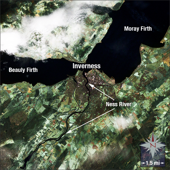
Inverness, in northern Scotland, is known as “The Capital of the Highlands.†The city derives its name from the Scots’ Gaelic term “Inbhir Nis†which translates as “mouth of the Ness.†It officially became a city in 2001 after competing with other locations to be awarded the status of “city.â€
In this image, you can see a patchwork of agricultural fields in green and brown. Inverness is centrally located and appears dark brown and white; it is split by the River Ness.
This Landsat 7 image was acquired on July 17, 2000. This is a natural-color image using ETM+ bands 3,2,1 and the panchromatic band. Inverness falls on Landsat WRS-2 Path 205 Row 20.
References
- Science Blogs. Lake Missoula. Accessed July 28, 2009 - external link
- Wikipedia. Glacial Lake Missoula. Accessed July 31,2009 - external link
NASA GSFC Landsat/LDCM EPO Team