Lake Missoula
Downloads
- L71044027_02720020613_243_tweak.tif (4447x4447, TIFF)
Metadata
- Sensor(s):
- Landsat 7 - ETM+
- Data Date: June 1, 2001
- Visualization Date: August 5, 2009
The ancient Glacial Lake Missoula was formed approximately 19,000 years ago when the Cordilleran Ice Sheet created an ice dam in the Clark Fork River Valley. The glaciel lake was located over what is now the valleys of modern day Montana. It was created by the “Missoula Floods†which reached a depth of 1,970 feet and contained 1,242 cubic miles of water —more than that of Lake Ontario and Lake Erie combined. The unique striping etched into the hillsides of the area around Missoula indicate the shorelines of the ancient lake.
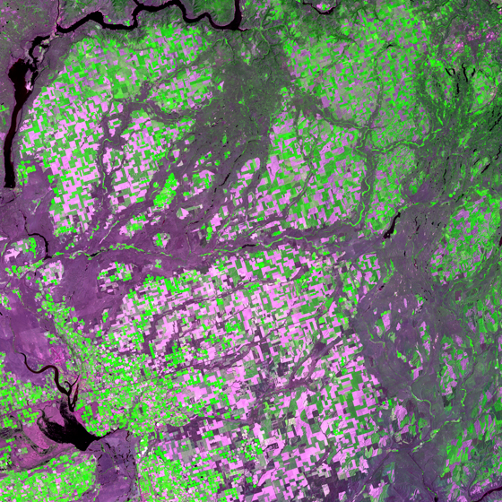
This image shows a Landsat view of the Channeled Scablands region. The channels were carved from floodwaters from Glacial Lake Missoula and were up to 597 feet deep and 20 miles wide. The Scabland channels of eastern Washington are shown in purple, the vegetation is green, and agriculture in beige.
This false color Landsat 7 image was collected on June 1, 2001. It was created using bands 2, 4 and 3 and is found on Landsat WRS-2 Path 44 Row 27.
References
- Science Blogs. Lake Missoula. Accessed July 28, 2009 - external link
- Wikipedia. Glacial Lake Missoula. Accessed July 31,2009 - external link
NASA GSFC Landsat/LDCM EPO Team