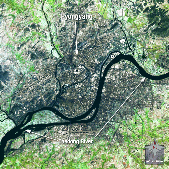
acquired September 17, 2002
Pyongyang, North Korea
Downloads
- Pyongyang.tif (10460x10460, TIFF)
Metadata
- Sensor(s):
- Landsat 7 - ETM+
- Data Date: September 17, 2002
- Visualization Date: July 30, 2009
Pyongyang is the capital of North Korea, located in the southwestern corner of the country. It is the largest city in North Korea with a population of approximately 3.2 million.
In this image, Pyongyang appears grey in color and is surrounded by vegetation (in green). The Taedong River, shown in dark blue, travels through the city.
This Landsat 7 pan-sharpened image was acquired on September 17, 2002. This is a natural-color image using ETM+ bands 3, 2, 1 and the panchromatic band. Pyongyang falls on Landsat WRS-2 Path 111 Row 70.
References
- Wikipedia. Pyongyang. Accessed June 3, 2009 - external link
NASA GSFC Landsat/LDCM EPO Team