Fires in Guatemala
Downloads
- guatemala_fires_oli_20240225_lrg.jpg (3199x2133, JPEG)
Metadata
- Sensor(s):
- Landsat 8 - OLI
- Data Date: February 25, 2024
- Visualization Date: February 27, 2024
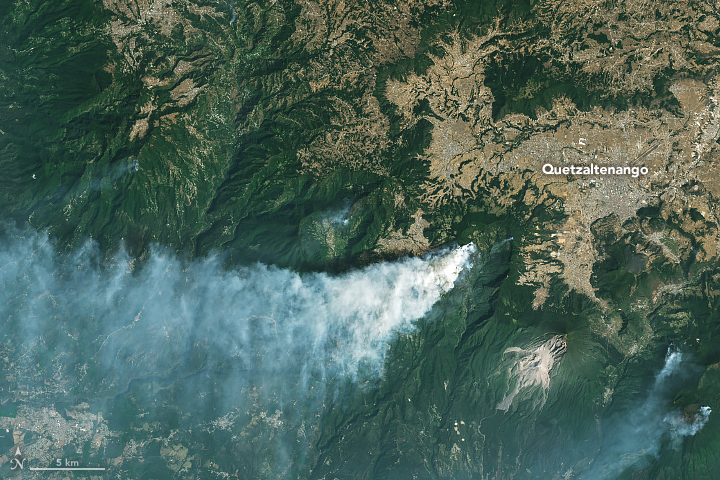
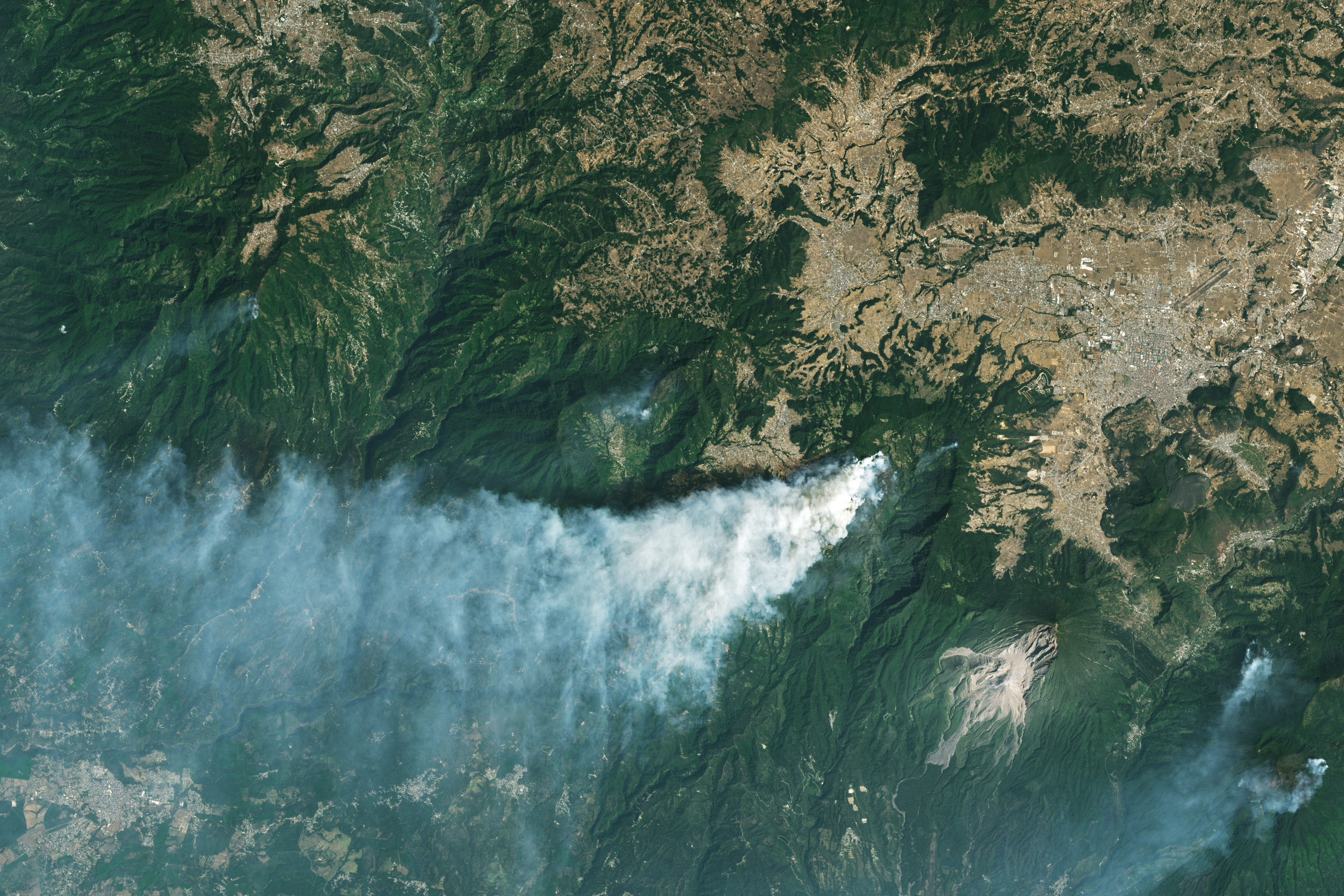
Late in February 2024, hot, dry, and windy weather fueled several large forest fires in the highlands of Guatemala. On February 25, the OLI (Operational Land Imager) on Landsat 8 acquired this image of a large fire burning southwest of Quetzaltenango.
The fire burned across the forested slopes of Siete Orejas, an inactive volcano that last erupted between 126,000 and 85,000 years ago. Siete Orejas hosts several endemic species, including the endangered Guatemalan fir or “pinabete.”
In Guatemala, fire season typically begins in February and lasts around three months. It is not possible to know the cause of a given fire based on satellite imagery alone, but many fires are initially lit to clear land for planting crops or to encourage the growth of pasture grasses. As rains taper off during the dry season, these small fires sometimes escape into forests and burn as wildfires.
About 200 kilometers (125 miles) southeast of Siete Orejas, firefighters are battling another large fire on Agua, a dormant volcano near the city of Antigua. Though that fire is burning southeast of the Landsat image above, the MODIS (Moderate Resolution Imaging Spectroradiometer) on NASA’s Terra satellite captured an image of the fire on February 24.
On February 27, the Guatemalan Coordinating Agency for Disaster Reduction (CONRED) reported that firefighters were battling 27 fires, including fires in the departments of Alta Verapaz, Baja Verapaz, Chimaltenango, El Progreso, Huehuetenango, Quiché, Sacatepéquez, Sololá, Suchitepéquez, Totonicapán, and Zacapa. They reported that 478 fires have burned 1,377 hectares since the start of the current fire season.
References
- Coordinating Agency for Disaster Reduction Public Notices. Accessed February 27, 2024.
- Coordinating Agency for Disaster Reduction Facebook Updates. Accessed February 27, 2024.
- Disasters Charter (2024) Wildfire in Guatemala. Accessed February 27, 2024.
- GT News (2024, February 25) The Executive Branch is making efforts to mitigate forest fires. Accessed February 27, 2024.
- La Prensa Latina (2024, February 23) Guatemala asks for international help to fight wildfires. Accessed February 27, 2024.
- Mongabay (2019, February 1) How a Mayan town restored its sacred cloud forest and water supply. Accessed February 27, 2024.
- NASA Fire Information for Resource Management System Global Fire Map. Accessed February 27, 2024.
- NASA Earthdata Wildfires Data Pathfinder. Accessed February 27, 2024.
- The Tico Times (2024, February 22) Forest Fires Engulf Agua Volcano’s Slopes, Guatemala Battles the Blaze. Accessed February 27, 2024.
NASA Earth Observatory image by Michala Garrison, using Landsat data from the U.S. Geological Survey. Story by Adam Voiland.
This image record originally appeared on the Earth Observatory. Click here to view the full, original record.