Port of Rio Grande
Downloads
- sedimentsships_oli2_2023278 _lrg.jpg (2352x1568, JPEG)
Metadata
- Sensor(s):
- Landsat 9 - OLI-2
- Data Date: October 5, 2023
- Visualization Date: December 8, 2023
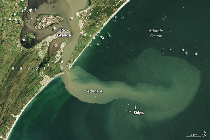
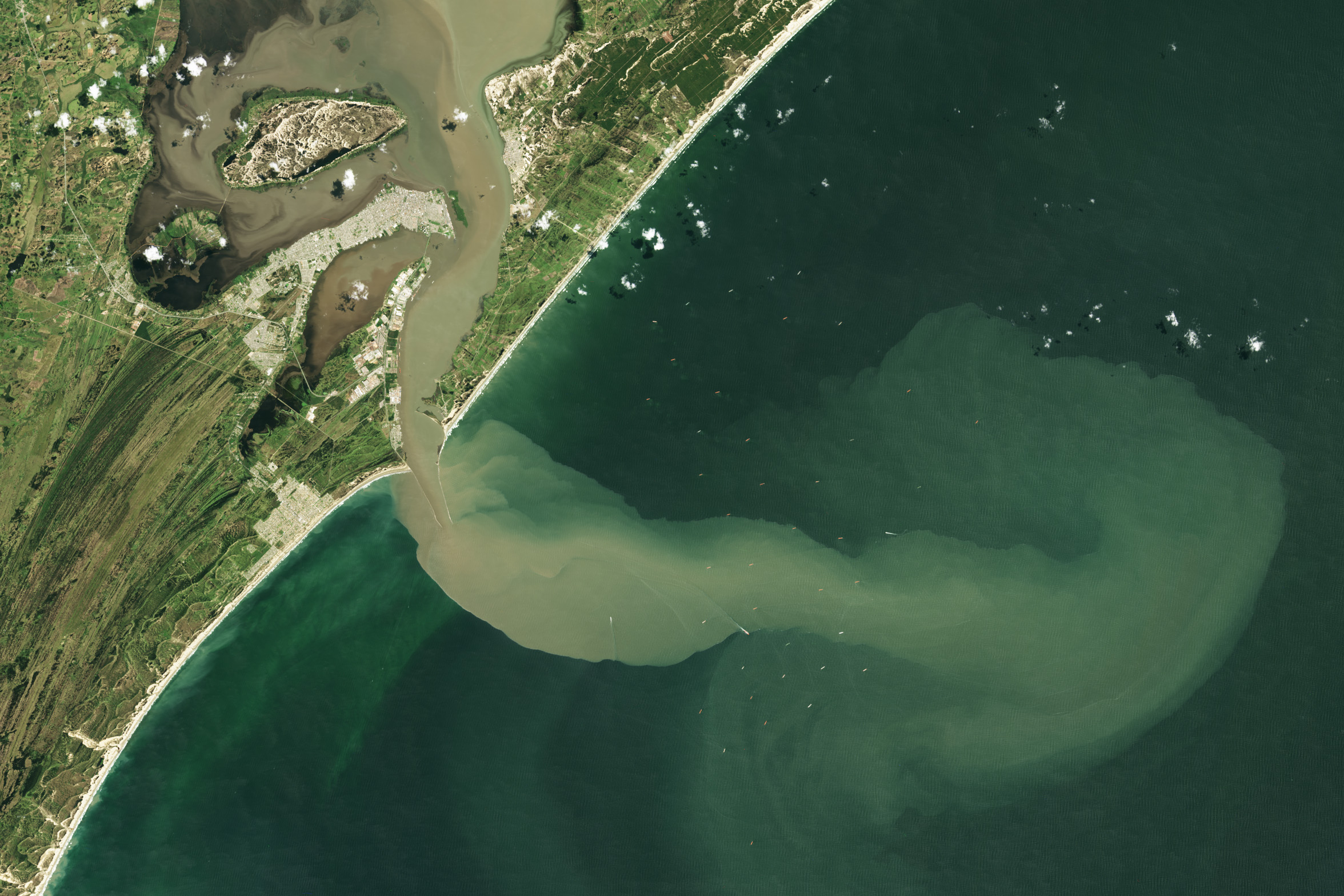
Sea-faring vessels lingered off the shores of the Port of Rio Grande in southern Brazil on October 5, 2023, when the OLI-2 (Operational Land Imager-2) on Landsat 9 acquired this image. Some of the vessels were likely waiting to enter the 39-kilometer (24-mile) channel that connects the Atlantic Ocean to the Patos Lagoon (Lagoa dos Patos).
The ships cruised in Atlantic waters colored brown by a large plume of suspended sediment. In the days prior, heavy rain caused widespread flooding and damage in the states of Santa Catarina and Rio Grande do Sul. Muddy water spilled over the banks of the Jacuí River, which flows by the city of Porto Alegre—an industrial hub for the region. Sediment-rich water then poured into the lagoon and emptied into the Atlantic.
The weather event continued a trend of wet weather in southern Brazil from September to November 2023. Brazil’s National Institute of Meteorology attributed the increased intensity and frequency of rainfall events in the south mainly to El Niño, and the agency forecast these trends would continue throughout December 2023.
Sediment that has settled and accumulated along the bottom of the port’s channel is dredged every year to ensure vessels can easily travel to and from the port. Soybean products, wheat, beef, fertilizers, and petroleum are some of the main imports and exports through the port.
References & Resources
- Brazil National Institute of Meteorology (Instituto Nacional de Meteorologia, INMET) (2023, November 22) El Niño 2023: November bulletin. Accessed December 6, 2023.
- FloodList (2023, October 11) Brazil — Rains and Floods Wreak Havoc in Santa Catarina as Emergency Declarations Escalate. Accessed December 6, 2023.
- NASA Earth Observatory (2023, December 2) Flooding in Southern Brazil. Accessed December 6, 2023.
- NASA OB.DAAC, Ocean Color Image Gallery Sediment Runoff in the Rio Grande Anchorage. Accessed December 6, 2023.
- ReliefWeb Brazil: Floods — Sep 2023. Accessed December 6, 2023.
NASA Earth Observatory image by Wanmei Liang, using Landsat data from the U.S. Geological Survey. Story by Emily Cassidy.
This image record originally appeared on the Earth Observatory. Click here to view the full, original record.