
A Sandy Haven in Japan
Downloads
- japanpeninsula_oli_2022183_lrg.jpg (997x665, JPEG)
- japanpeninsula_oli_2022361_lrg.jpg (997x665, JPEG)
Metadata
- Sensor(s):
- Landsat 8 - OLI
- Data Date: July 2, 2022 - December 27, 2022
- Visualization Date: May 25, 2023
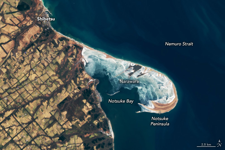
On the eastern shore of Hokkaido, a hook-shaped spit juts into the Nemuro Strait. The 28-kilometer-long (17-mile-long) feature, Notsuke Peninsula, is one of the largest sand spits in Japan.
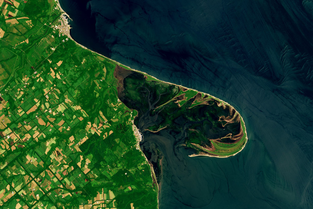
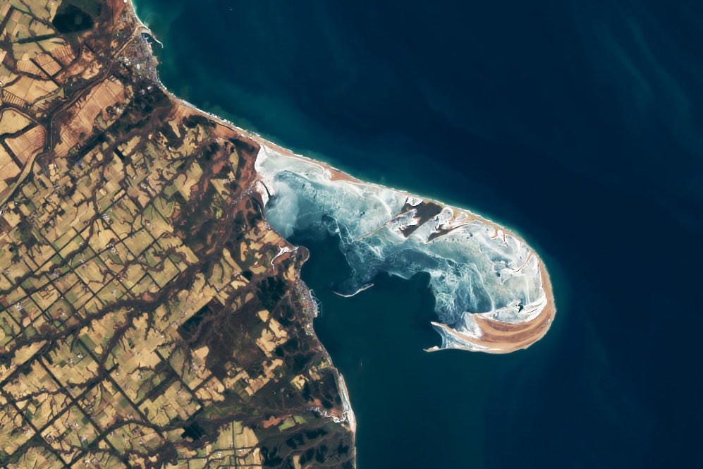
The pair of Landsat images above shows the peninsula in the summer (left) and winter (right). In the summer image, patches of sea grass and kelp (green) are visible in the shallow waters of Notsuke Bay, an area mostly enclosed by the peninsula where the water depth generally averages less than 1 meter (3 feet). The Operational Land Imager (OLI) on Landsat 8 acquired the summer image on July 2, 2022; the same sensor captured the winter image on December 27, 2022.
The sheltered waters of the bay serve as a key habitat, food source, and nursery for a variety of sea life, including Hokkai shrimp, salmon, and migratory waterbirds. To avoid damaging the seagrass and clogging the propellors of motorized boats, local fishermen instead use traditional sailboats called Utasebune to harvest shrimp. As seen in the winter image, the bay’s shallow waters freeze over during the coldest months of winter, creating a vast expanse of frozen water known locally as an “ice horizon.”
The spit is made up mostly of sand and sediment that is carried by the Shibetsu River and then transported south by longshore currents along the Nemuro Strait. However, sediment has been in short supply in recent decades due to the construction of a port in Shibetsu that blocks some of the sediment from moving south.
Regular dredging, the construction of groin structures to prevent erosion, and a variety of beach nourishment projects have helped Notsuke Peninsula remain intact. However, Landsat satellite images show the peninsula narrowing in some areas in recent decades in the face of ongoing wave action and erosion, sea level rise, and the gradual subsidence of the landscape. Indeed, salty water encroaching on forested patches of the peninsula has left dying ghost forests in areas such as Narawara and Todowara.
References
- Betsuki Town Office Notsuke-Hanto and Notsuke-wan. Accessed May 26, 2023.
- Hayashi, K., et al. (2010) Beach morphologies at Notsukezaki Sand Spit, Japan. Accessed May 26, 2023.
- ICCE (2018) Storm-Induced Erosion of Notsukezaki. Accessed May 26, 2023.
- NASA Earth Observatory (2020, May 6) A Windbreak Grid in Hokkaido. Accessed May 26, 2023.
- Notsuke Peninsula Nature Center Notsuke Peninsula Ice Horizon. Accessed May 26, 2023.
- Ramsar (2005) Notsuke-hanto and Notsuke-wan. Accessed May 26, 2023.
- Hokkaido Magazine Ahead of Notsuke Peninsula, the entrance to a whole world. Accessed May 26, 2023.
NASA Earth Observatory images by Wanmei Liang, using Landsat data from the U.S. Geological Survey. Story by Adam Voiland.
This image record originally appeared on the Earth Observatory. Click here to view the full, original record.