Jagersfontein Covered in Mining Waste
Downloads
- minesafrica_oli_2022253_lrg.jpg (3620x3548, JPEG)
- minesafrica_oli2_2022277_lrg.jpg (3620x3548, JPEG)
Metadata
- Sensor(s):
- Landsat 8 - OLI
- Landsat 9 - OLI-2
- Data Date: September 10, 2022 - October 4, 2022
- Visualization Date: October 19, 2022
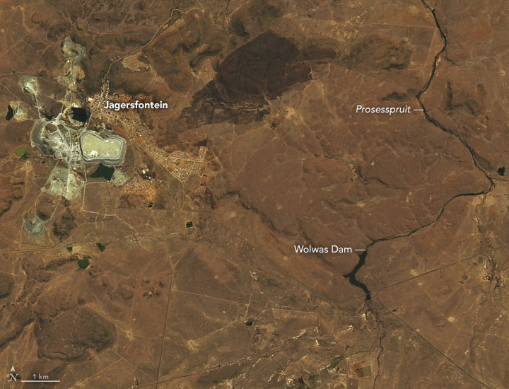
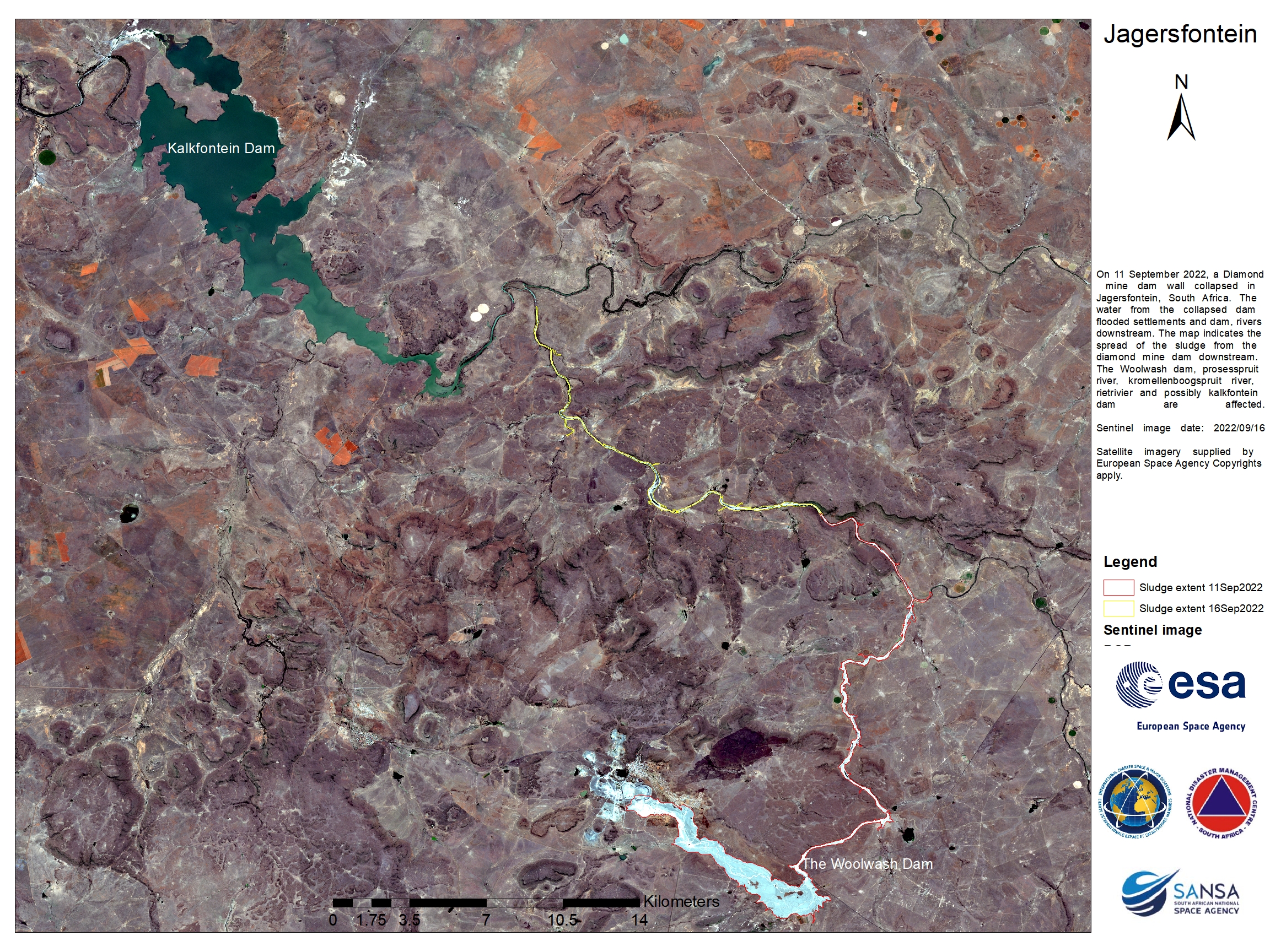
On September 11, 2022, a dam collapsed at a diamond mine in Jagersfontein, South Africa, and released a watery mixture of mining waste known as tailings. The sludge poured across the landscape, destroying homes, inundating rivers and grazing land, and injuring dozens.
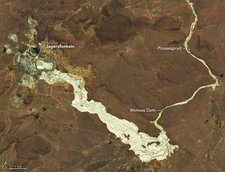
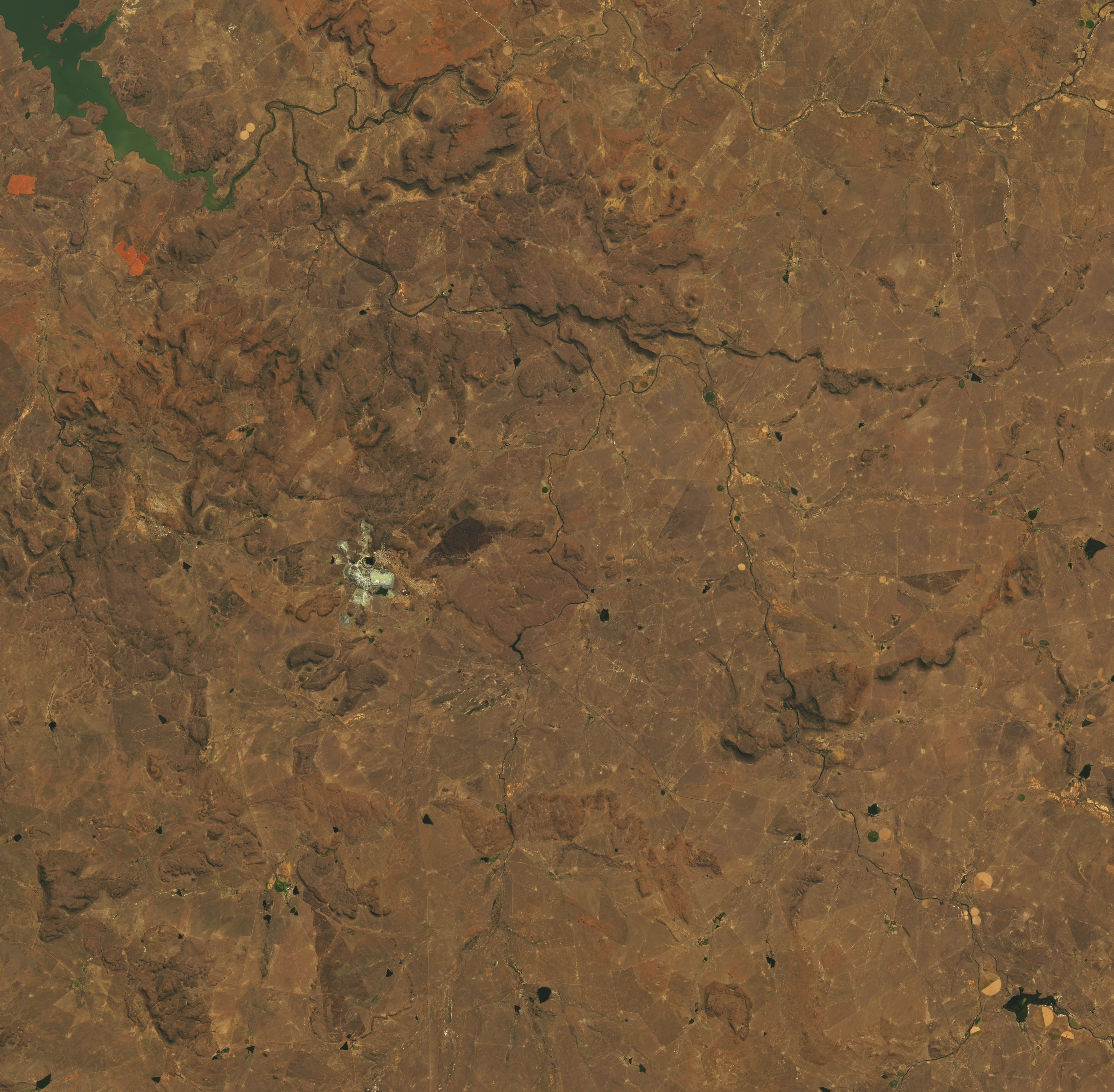
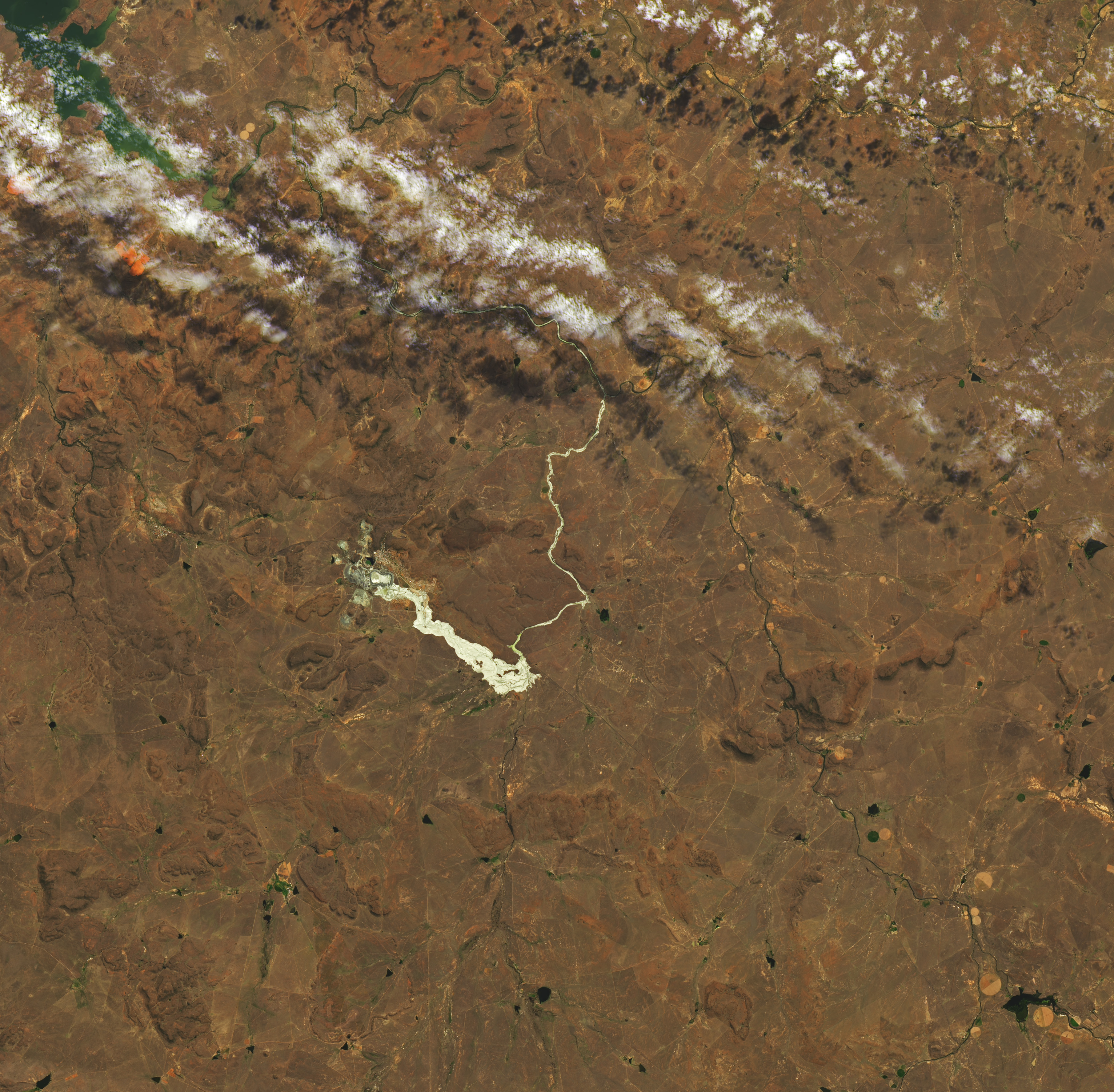
Almost one month after the incident, satellite images show that the landscape remains altered by the coating of sludge. The Operational Land Imager-2 (OLI-2) on Landsat 9 acquired this image (right) on October 4, 2022. For comparison, the Operational Land Imager (OLI) on Landsat 8 acquired the other image (left) on September 10, the day before the dam collapse.
The breach in the dam is visible on its southern side, through which most of the tailings poured out. Analysis of satellite images by geologist Dave Petley indicated that the plume reached up to 1.5 kilometers (1 mile) wide and extended about 8.5 kilometers (5.3 miles) toward the southeast. The sludge then turned north and entered several streams and rivers, including the Prosesspruit, and continued to at least Kalkfontein Dam (north of this image). It reached water systems used for drinking water and for agriculture.
As the water receded, it left behind white and tan deposits. The lightest areas in this image are likely dried tailings and mud. Notice that the banks of the Prosesspruit appear wider after being eroded and damaged by the flood.
According to news reports, the flood destroyed more than 160 homes, killed at least one person and hundreds of animals, and damaged more than 26 square kilometers (10 square miles) of grazing land. It remains to be seen how long the muck will persist. As the material dries out and hardens it could begin to blow away with the wind or be washed away by rains.
References
- Floodlist (2022, September 12) South Africa—Mining Dam in Jagersfontein Collapses Leaving 3 Dead, 4 Missing. Accessed October 19, 2022.
- International Charter Space & Major Disasters (2022, September 12) Charter Activations: Flood in South Africa. Accessed October 19, 2022.
- The Landslide Blog (2022, September 26) High resolution satellite imagery of the Jagersfontein tailings dam failure. Accessed October 19, 2022.
- The Landslide Blog (2022, September 13) Analysing the aerial and satellite imagery of the Jagersfontein tailings dam disaster. Accessed October 19, 2022.
- The Landslide Blog (2022, September 12) The 11 September 2022 Jagersfontein tailings dam failure. Accessed October 19, 2022.
- Mail&Guardian (2022, October 13) Jagersfontein dam collapse to cost hundreds of millions of rands. Accessed October 19, 2022.
- Mail&Guardian (2022, September 22) Cleaning up an ‘ecological tragedy’: Jagersfontein Developments did not have a dam safety licence. Accessed October 19, 2022.
- The New York Times (2022, September 23) The World Got Diamonds. A Mining Town Got Buried in Sludge.. Accessed October 19, 2022.
- Reuters (2022, September 28) S.Africa’s Free State backpedals on dam collapse statement. Accessed October 19, 2022.
- Reuters (2022, September 11) South Africa mine dam wall collapses, killing 1 and injuring 40. Accessed October 19, 2022.
- Sentinel Vision (2022, September 15) Deadly dam collapse in a diamond mine, RSA. Accessed October 19, 2022.
NASA Earth Observatory images by Lauren Dauphin, using Landsat data from the U.S. Geological Survey. Story by Kathryn Hansen.
This image record originally appeared on the Earth Observatory. Click here to view the full, original record.