Rising Flood Risks in Bangladesh
Downloads
- dhaka_tm_198850_lrg.jpg (1817x1747, JPEG)
- dhaka_oli_202279_lrg.jpg (1817x1747, JPEG)
- bangladesh_vir_2021335_lrg.jpg (2258x2195, JPEG)
Metadata
- Sensor(s):
- Landsat 5 - TM
- Landsat 8 - OLI
- Suomi NPP - VIIRS
- Data Date: February 19, 1988 - March 20, 2022
- Visualization Date: August 29, 2022
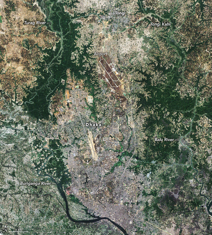
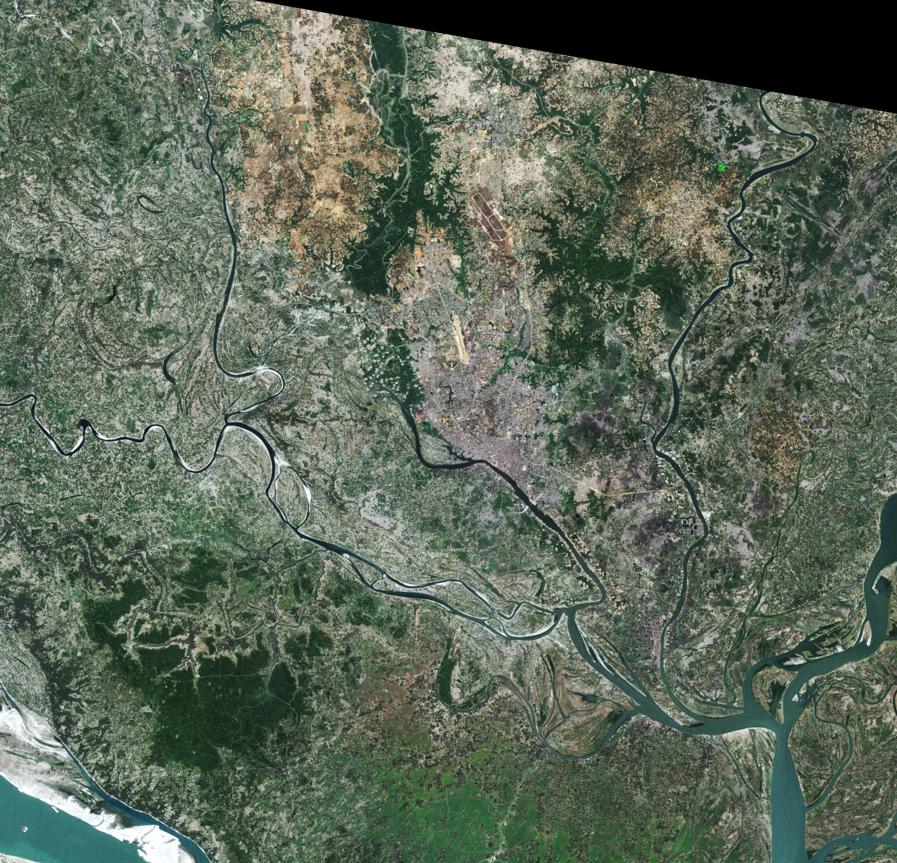
From 1988 to 2022, the population of Dhaka ballooned from 5.7 million people to more than 22 million. That tremendous rate of growth has made Bangladesh’s capital among the most densely populated cities in the world. It also means many more people now live in areas prone to flooding.
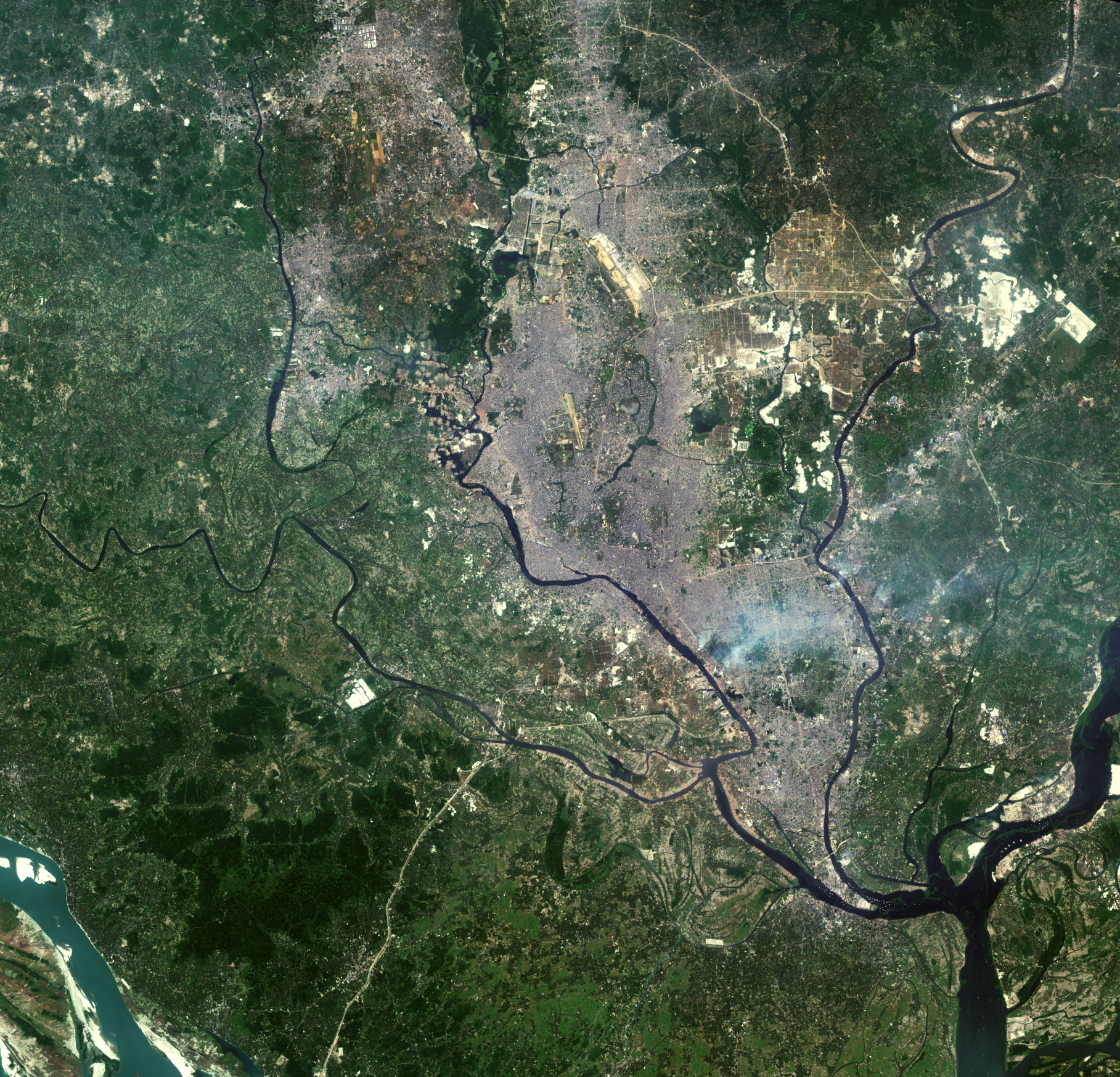
The growth of the city is evident in the Landsat images above. The Thematic Mapper on Landsat 5 captured the first image on February 19, 1988; the Operational Land Imager (OLI) on Landsat 8 captured the second on March 20, 2022.
The city is surrounded by rivers and tributaries: the Buriganga to the south, the Turag to the west, the Tongi Khal to the north, and the Balu to the east. According to one recent analysis of Dhaka’s population since 2000, growth has been particularly rapid along the Buriganga and the Balu rivers.
A team of researchers from Penn State, Curtin University, and the University of Chittagong recently analyzed satellite observations of nighttime lights and land use to track population growth in flood-prone areas. In June 2022, they reported that roughly 70 million people in Bangladesh now live in flood-prone areas (within 2 kilometers of a river), about 1.5 million more than in 2000. In Dhaka, about 6 million people live in flood zones.
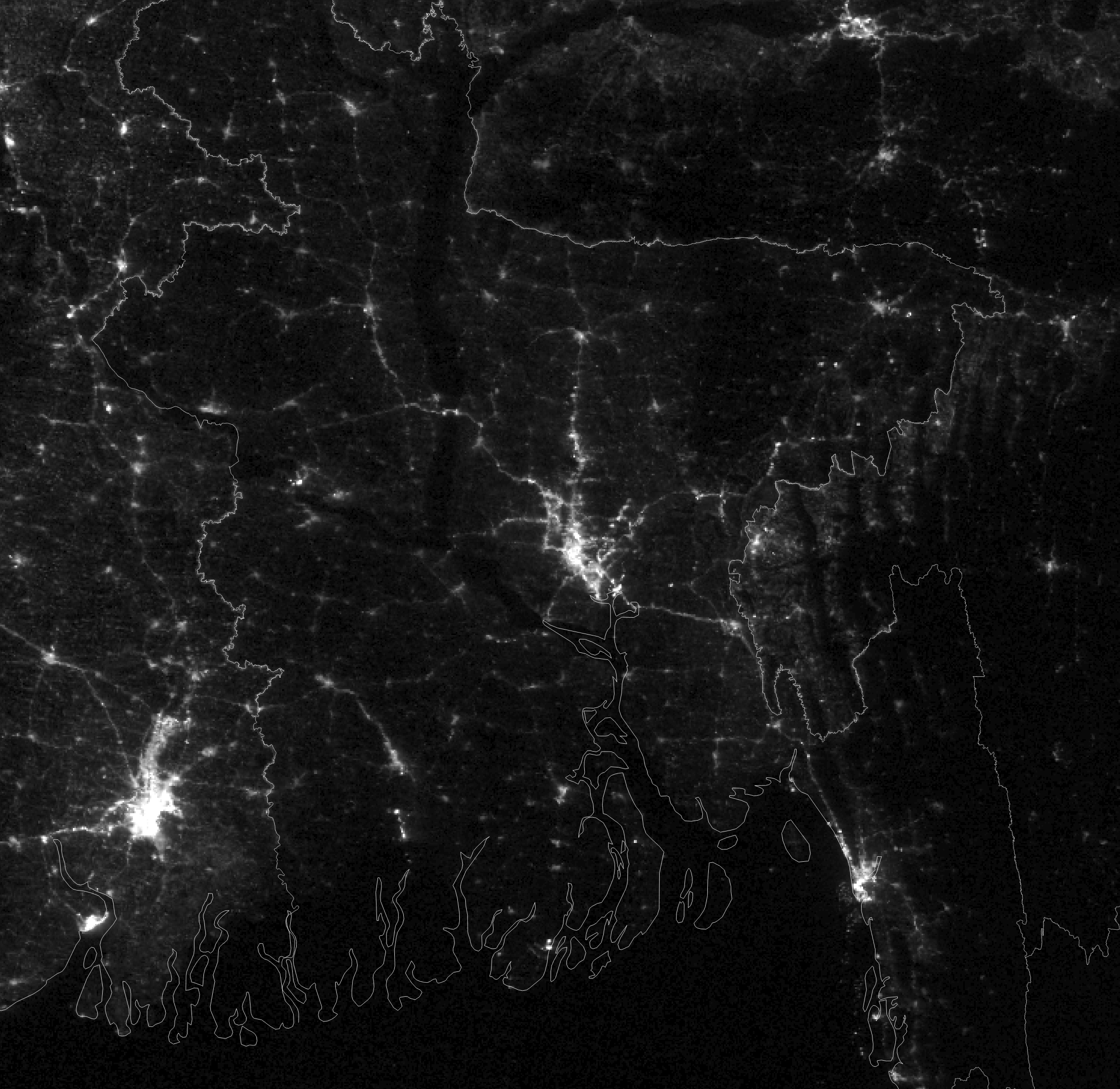
The researchers based part of their analysis on nighttime observations from the Operational Linescan System (OLS) on U.S. Defense Meteorological Satellite Program satellites and the Visible Infrared Imaging Radiometer Suite (VIIRS) on the Suomi-NPP satellite. Cities throughout Bangladesh saw increased light in floodplains throughout the country from 2000 to 2018. Dhaka, Chattogram, Khulna, Sylhet, and Mymensingh were among the cities with pronounced increases. The image above shows nighttime lights in Bangladesh as observed with the VIIRS day-night band on December 1, 2021.
“The total nighttime light luminosity within 2 kilometers of rivers increased by 235 percent throughout Bangladesh,” said Arif Masrur, the Penn State University geographer who co-authored the study. “As the population grows, the scarcity of land is fueling unplanned development in floodplains. More people are moving into floodplains to farm rice or fish, or to simply have somewhere to live.”
The number of people in floodplains may even be larger than the nighttime luminosity data suggests. “It is safe to assume that many households within 2 kilometers of rivers lack connections to the electrical grid,” explained Ashraf Dewan, an environmental geographer based at Curtin University and co-author of the study. “While OLS and VIIRS can detect whole villages reliably, the sensors don’t always detect more isolated homes or homes that use power sparingly to save money, particularly in areas with lots of vegetation.”
Floods in 1988 swamped Dhaka and led to the deaths of more than 2,000 people. Another catastrophic flood in 1998 killed 900 people and caused $3.5 billion in damages, according to Dewan.
In some parts of the low-lying city, shanty towns and other informal settlements have pushed into ephemeral wetlands known as khals, sharply increasing the risks from damaging monsoon season floods. A prime example is Korail, a poor neighborhood that has spread into a lake. Homes are built on stilts and the neighborhood routinely floods during heavy rains.
“We hope this research makes the scale of the issue clear for policymakers,” said Dewan. “If this trend continues, more homes will be destroyed, and more lives will be lost.”
References
- Bloomberg (2022, June 28) Climate Migration Pushes Bangladesh’s Megacity to the Brink. Accessed August 29, 2022.
- Dewan, A. et al., (2004) Remote Sensing of 1998 and 2000 Floods in Greater Dhaka, Bangladesh: Experiences from Catastrophic and Normal events. Journal of the Faculty of Environmental Science and Technology, 10 (1), 57-65.
- Dewan, A. & Corner, R. (2014) Spatiotemporal Analysis of Urban Growth, Sprawl and Structure. (Dordrecht: Springer)
- Dewan, A. (2013) Floods in a megacity: geospatial techniques in assessing hazards, risk and vulnerability. (Dordrecht: Springer)
- Masrur, A. et al., (2022) Dynamics of human presence and flood-exposure risk in close proximity to Bangladesh’s river network: an evaluation with multitemporal satellite imagery. Geocarto International.
- Tellman, B. et al. (2021) Satellite imaging reveals increased proportion of population exposed to floods. Nature, 598, 80-86.
NASA Earth Observatory images by Lauren Dauphin, using Landsat data from the U.S. Geological Survey and VIIRS day-night band data from the Suomi National Polar-orbiting Partnership. Story by Adam Voiland.
This image record originally appeared on the Earth Observatory. Click here to view the full, original record.