Everest-Area Plant Life Spreads
Downloads
- himalaya_oli_1993-2017_lrg.jpg (1440x720, JPEG)
- Nepal_pho_2017.JPG (720x480, JPG)
Metadata
- Sensor(s):
- Landsat 5 - TM
- Landsat 7 - ETM+
- Landsat 8 - OLI
- Data Date:
- Visualization Date: January 11, 2022
In 2017, while exploring rock glaciers in the Himalaya, eco-hydrologist Karen Anderson couldn’t help but wonder about the plants. Shrubs and grasses seemed to be thriving across many of the high-altitude mountain slopes.
The landscape made her wonder: “Is there more plant coverage now than in the past?” The question seems simple, but the answer has complex and important implications for the region’s water cycle. Research in other parts of the world has shown that changes in the type and expanse of vegetation can lead to changes in the flows and stores of water. So, an expansion of plants in the Himalaya—not just the retreat of glaciers—could affect the water supply for one fifth of Earth’s human population.
But how this plant-water relationship will play out remains unclear. “There is such a lack of information about Himalayan ecology in this high-altitude zone, at least in western science, that we don’t really understand what the impacts of changing vegetation will be,” Anderson said. “Most of the scientific expeditions to the Himalaya have been to the glaciers, which have been an area of major concern as they retreat under climate change.”
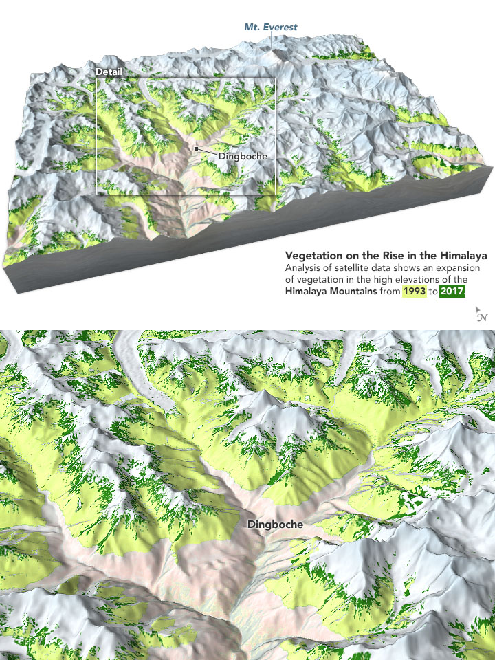
Anderson and colleagues set out to evaluate how plant life has changed in the Hindu Kush Himalaya over the span of 26 years. They focused on elevations above the tree line but below permanent snow and ice. In this area, known as the subnival or alpine zone, you can find shrubby plants and seasonal snow. In the Himalaya, the zone generally includes altitudes between 4,100 to 6,000 meters (13,000 to 20,000 feet) above sea level.
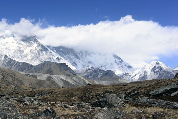
The high altitude and the remoteness of the region add to the challenge of studying its plants. But Anderson, based at the University of Exeter (England), did not need to return to Nepal to begin the investigation. Instead, she and colleagues used the Normalized Difference Vegetation Index, or NDVI, derived from Landsat satellites. NDVI gives an indication of the land’s greenness, which the scientists used to map the abundance of vegetation across the subnival zone from 1993 to 2018. They checked the accuracy of their maps against images from Google Street View and the photographs Anderson shot during her field work in 2017 (above).
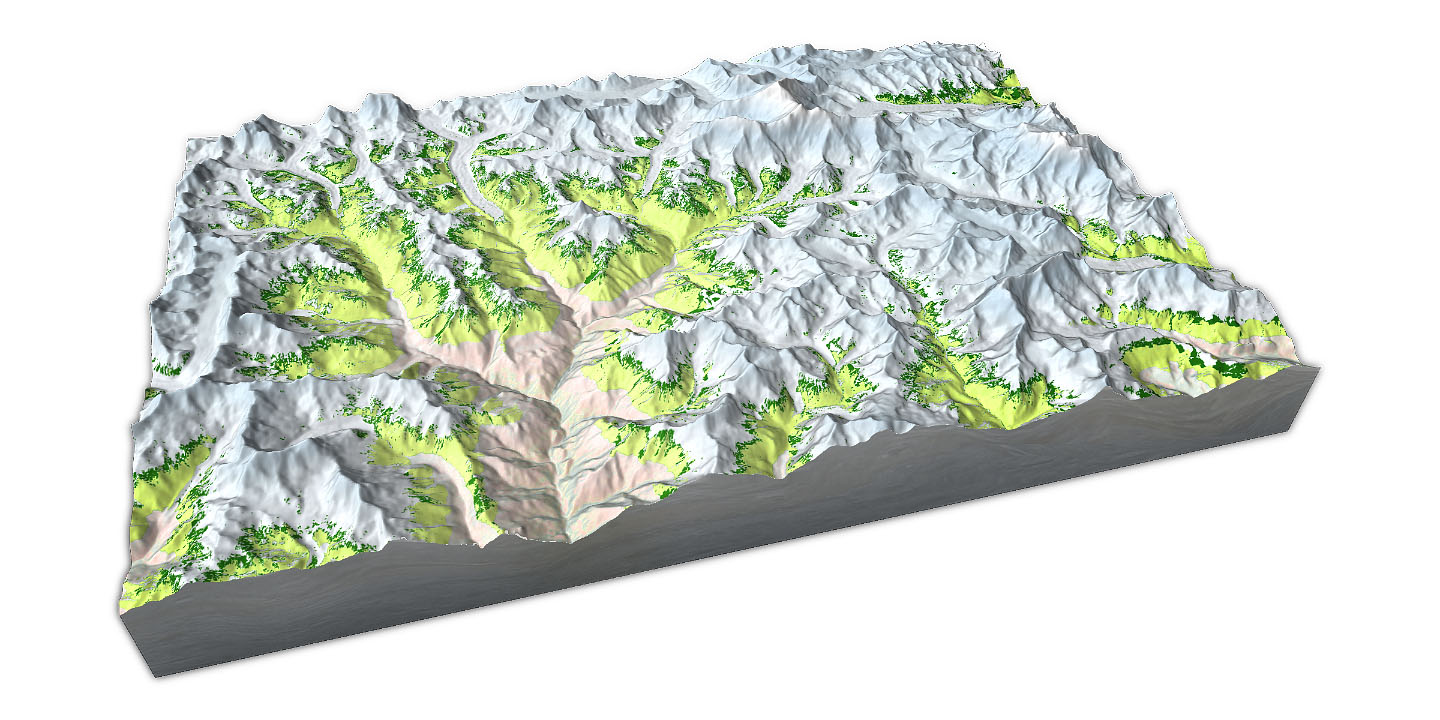
The maps at the top of this page show the extent of vegetation in 1993 (green-yellow) and 2017 (dark green). They span the mountainous area around Mount Everest and Dingboche, Nepal, a mountain village at an altitude of 4,410 meters (14,500 feet). Notice the small but significant increases in vegetation cover by 2017. Increases tended to be more substantial on steeper slopes at lower elevations, and on flatter areas at higher elevations. The findings were published in Global Change Biology.
“This work was the first step towards trying to explore the scale of this ecosystem, to describe how it is changing, and to discuss the likely implications,” Anderson said.
For example, the expansion of plants elsewhere in the world has been shown to alter the water cycle by intercepting rainfall or trapping snow. Plants also can warm the soil through albedo-driven effects, and they can cool the air through evapotranspiration.
“As glaciers recede and plants expand with climate change, what will this mean for water security?” Anderson asked. “I think this is a really important question and something that my research group is taking forward.”
References and Further Reading
- Anderson, K. et al. (2020) Vegetation expansion in the subnival Hindu Kush Himalaya. Global Change Biology, 26 (3), 1608–1625.
- University of Exeter (2020, January 10) Landsat Reveals Expanding Plant Life in the Everest Region.
NASA Earth Observatory images by Joshua Stevens, using data courtesy of Anderson, K., et al. (2021). Photography by Karen Anderson. Story by Kathryn Hansen.
This image record originally appeared on the Earth Observatory. Click here to view the full, original record.