A New Start for Iberá
Downloads
- ibera_oli_2021324_lrg.jpg (5087x3392, JPEG)
- ibera_amo_2021313_lrg.jpg (2093x1395, JPEG)
Metadata
- Sensor(s):
- Landsat 8 - OLI
- Aqua - MODIS
- Data Date: November 20, 2021
- Visualization Date: December 28, 2021
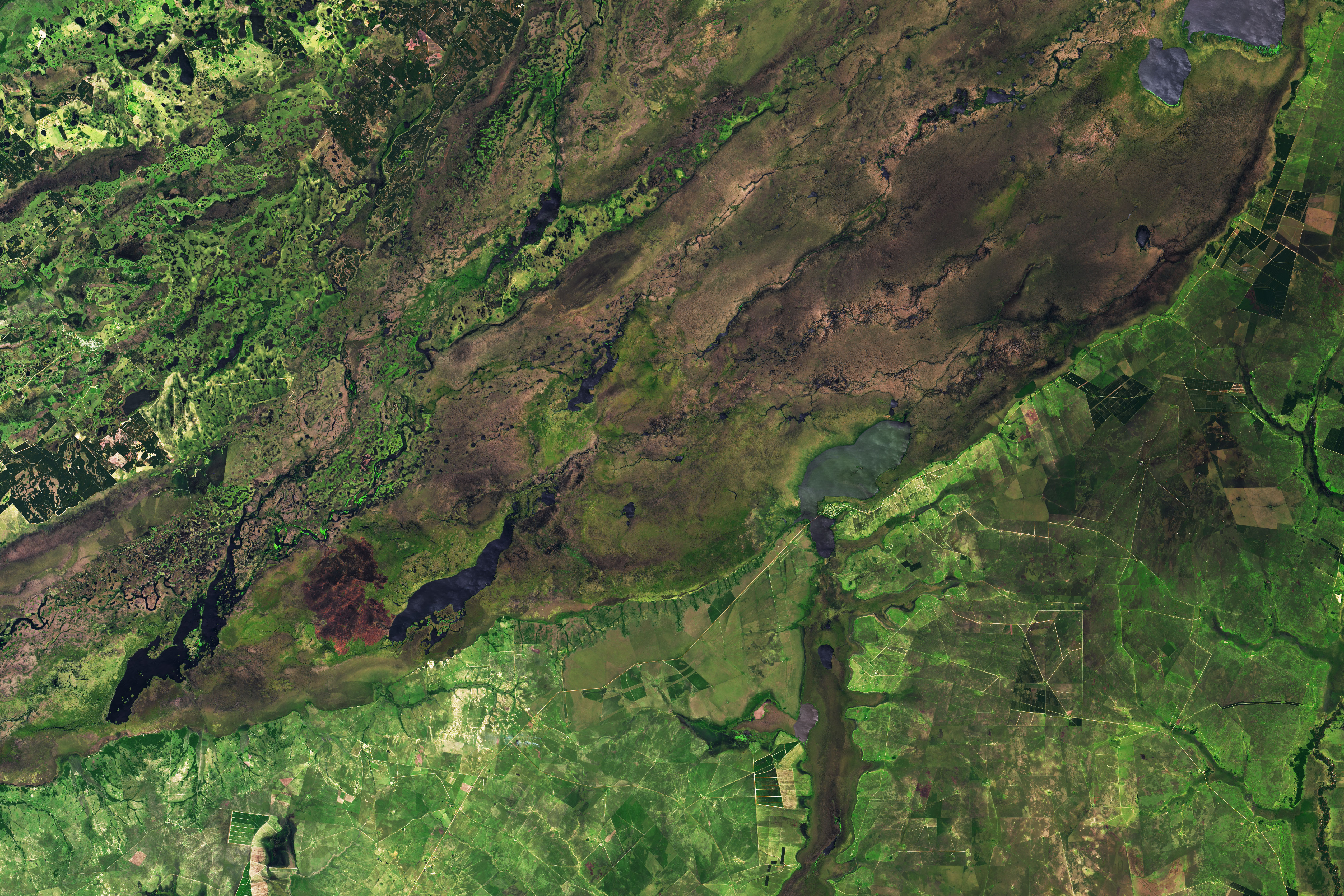
Decades ago, satellite observations of the lands surrounding the Iberá wetlands often showed signs of cattle production—roads, heavily grazed grasslands, and pasture fires. Today they are more likely to show lush grasslands, wetlands, and gallery forests living mostly untouched by human activity.
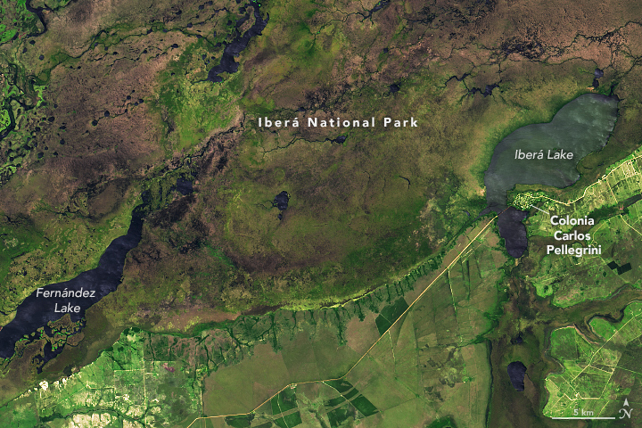
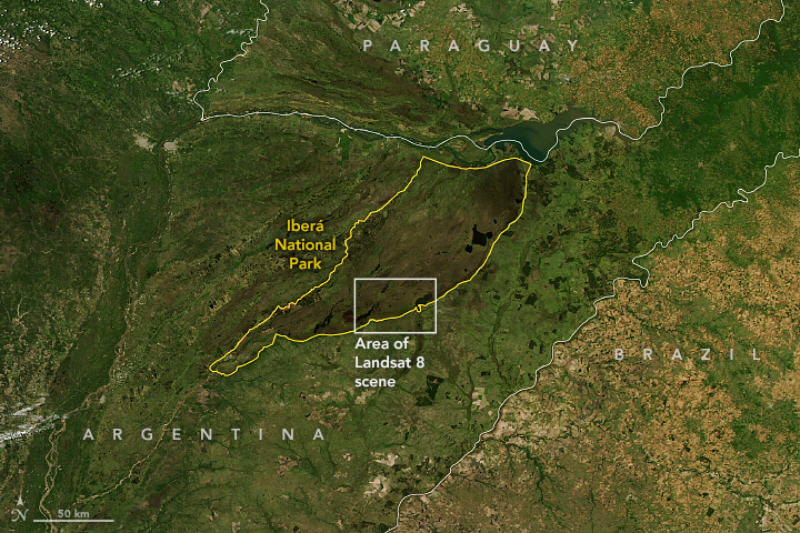
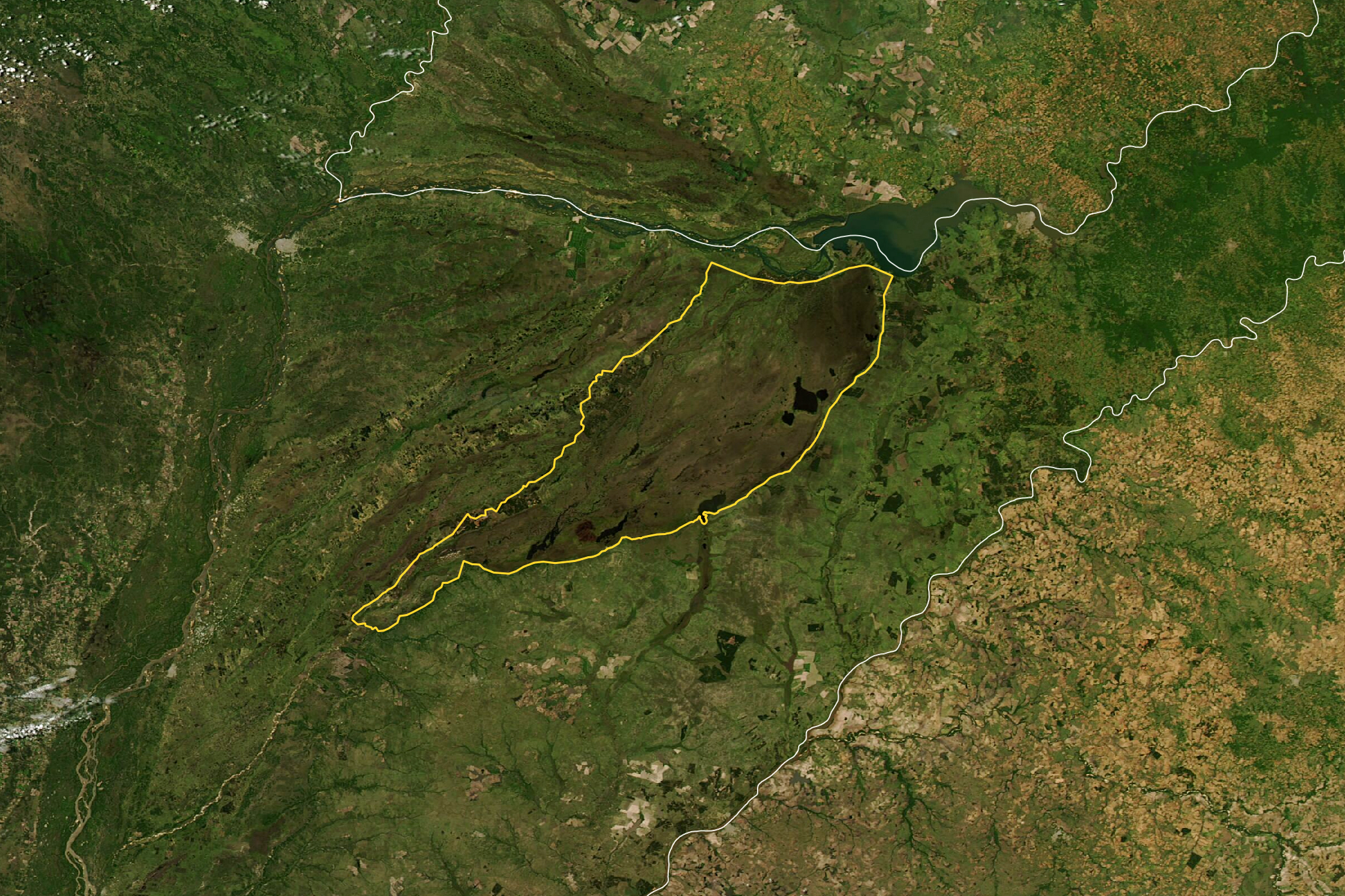
The image above, acquired on November 20, 2021, by the Operational Land Imager (OLI) on Landsat 8, shows part of Iberá National Park in northeast Argentina. Created in 2018 with land acquired by conservation groups and then donated to the government of Argentina, the park spreads across 1370 square kilometers (530 square miles) in the Corrientes Province. Some 4,000 species of flora and fauna live there, almost 30 percent of the total recognized in Argentina. The image of the whole park was acquired by the Moderate Resolution Imaging Spectroradiometer (MODIS) on NASA’s Aqua satellite.
The land to the west of Colonia Carlos Pellegrini in the Landsat image was used by a cattle ranch decades ago. After philanthropists bought the land, hundreds of miles of fences were taken down and cattle were moved out of the area. The property was converted into a lodge for visitors to the park.
As natural ecological processes reassert themselves, conservationists are pursuing a "rewilding" program that aims to bring back the animals that human activity drove from the area. The list includes jaguars, giant river otters, pampas deer, collared peccary, red-and-green macaw, bare-faced curassow, and the red-legged seriema.
References
- CNN (2020, January 22) Inside one of the world’s newest (and wettest!) national parks. Accessed December 29, 2021.
- Conservation Atlas (2018, January 1) Hope in Iberá: A Rewilding Story. Accessed December 29, 2021.
- Fundación Rewilding Argentina (2018, January 18) Rewilding Ibera Documentary (English version). Accessed December 29, 2021.
- Mata, J. et al. (2021) Enhancing monitoring of rewilding progress through wildlife tracking and remote sensing. PLOS One, 16 (7), e0253148.
- Pettersson, H. (2021) Rewilding and gazetting the Iberá National Park: Using an asset approach to evaluate project success. Conservation Science and Practice, 3 (5), e258.
- TED (2020) Let’s Make the World Wide Again. Accessed December 29, 2021.
- Tompkins Conservation (2021) Tompkins Conservation. Accessed December 29, 2021.
NASA Earth Observatory images by Lauren Dauphin, using Landsat data from the U.S. Geological Survey and MODIS data from NASA EOSDIS LANCE and GIBS/Worldview. Story by Adam Voiland.
This image record originally appeared on the Earth Observatory. Click here to view the full, original record.