Meandering to the Source
Downloads
- menderesriverzm_oli_202189.jpg (720x480, JPEG)
- menderesriver_oli_202189_lrg.jpg (3776x2029, JPEG)
Metadata
- Sensor(s):
- Landsat 8 - OLI
- Data Date: March 30, 2021
- Visualization Date: July 21, 2021
In Turkey, the spring-fed Büyük Menderes River twists and curves its way for 615 kilometers (382 miles) from its source near the town of Sandikli to the Aegean Sea. It is the longest river to discharge into the Aegean.
The river’s sinuous path captured the attention of historians and geographers of antiquity. Strabo wrote of its extreme windiness, and Herodotus referenced its twisting nature. The river’s ancient Greek name Maíandros, or Maeander, became synonymous with the bending character of river courses, and the modern geographical term “meander” was born.
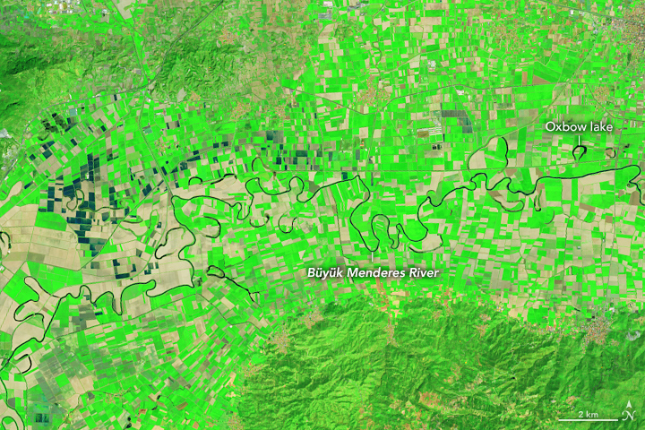
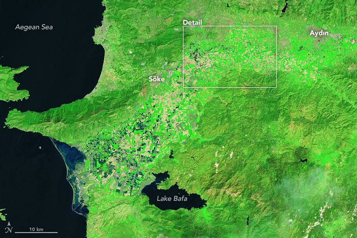
The false-color images above and below were acquired on March 30, 2021, by the Operational Land Imager (OLI) on Landsat 8. The twisting, meandering river, and the many oxbow lakes it has created, stand out as dark blue lines amid the bright green farms.
Much of the plain that the Büyük Menderes River flows through is what is known as graben, a seismically active depression in the landscape. In the Holocene Epoch, much of the plain has been an estuary; in fact, it was once the longest estuary of the Aegean Sea. But the brackish waterbody has been filled in by river sediment deposits from the Büyük Menderes over the past 3,500 years, leaving Lake Bafa as its only remnant. Today, many of the ancient harbors of Anatolia—such as Priene, Miletos, and Myous—are landlocked.
References
- Gürbüz, A., and N. Kazanci (2019) The Büyük Menderes River: Origin of Meandering Phenomenon. In Landscapes and Landforms of Turkey, 509-519. Springer International Publishing.
- Kazanci, N. et al. (2009) Quaternary deposits of the Büyük Menderes Graben in western Anatolia, Turkey: Implications for river capture and the longest Holocene estuary in the Aegean Sea. Marine Geology, 264 (3), 165–176.
- Mullenhoff, M., et al. (2004) The evolution of Lake Bafa (western Turkey)—sedimentological, microfaunal and palynological results. Geographie der Meere and Kusten: Coastline Reports, vol. 1, 55–66.
- Özpolat, E., et al. (2020) The Quaternary landforms of the Büyük Menderes Graben System: the southern Menderes Massif, western Anatolia, Turkey. Journal of Maps, 16 (2), 405–419.
NASA Earth Observatory images by Lauren Dauphin, using Landsat data from the U.S. Geological Survey. Story by Laura Rocchio, Landsat Communication and Public Engagement Team.
This image record originally appeared on the Earth Observatory. Click here to view the full, original record.
