An Outburst from Popocatépetl
Downloads
- popocatepetl_oli_20212_lrg.jpg (2460x1844, JPEG)
Metadata
- Sensor(s):
- Landsat 8 - OLI
- Data Date: January 2, 2021
- Visualization Date: January 6, 2021
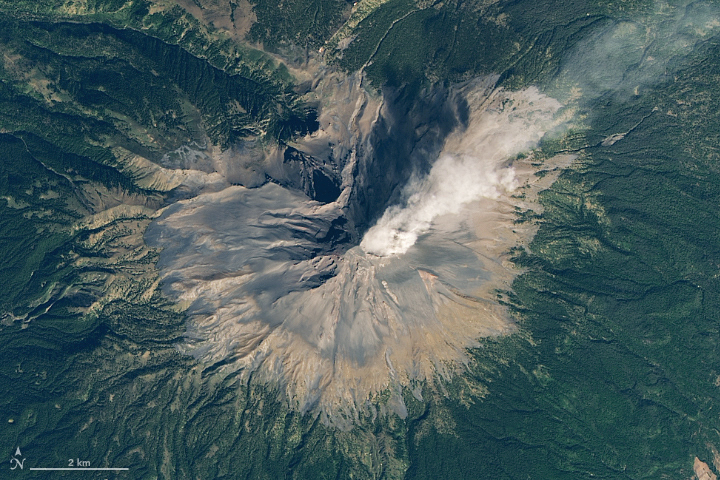
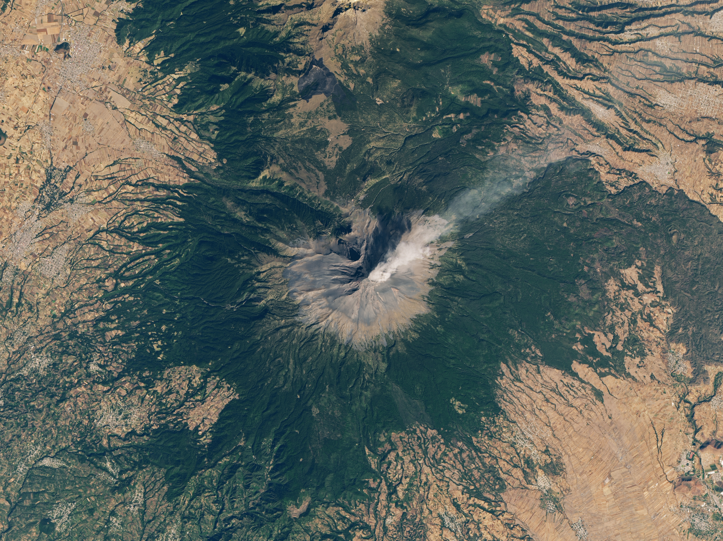
Popocatépetl volcano—the name is Aztec for “smoking mountain”—is one of Mexico’s most active volcanoes. The glacier-clad stratovolcano has been erupting since January 2005, with daily low-intensity emissions of gas, steam, and ash.
On January 2, 2021, the Operational Land Imager (OLI) on Landsat 8 captured this image of a plume rising from Popocatépetl (nicknamed El Popo).
On January 6, the Washington Volcanic Ash Advisory Center (VAAC) reported a volcanic ash plume that rose to around 6,400 meters (21,000 feet) above the volcano. Mexico’s National Center for Prevention of Disasters (CENAPRED), which continuously monitors Popo, warned people not to approach the volcano or its crater due to falling ash and rock fragments. Some ashfall was blown downwind to the city of Puebla, located about 45 kilometers (30 miles) away from the volcano.
At 5,426 meters (17,802 feet) above sea level, Popocatépetl is the second tallest volcano in Mexico (after Citlaltépetl). It is comprised of alternating layers of volcanic ash, lava, and rocks from earlier eruptions. The volcano is located around 70 kilometers (40 miles) southeast of Mexico City and more than 20 million people live close enough to be affected by a major eruption. However, most of the eruptions in the past 600 years have been relatively mild.
References and Further Reading
- Centro Nacional de Prevención de Desastres (2021, January 8) CENAPRED monitoring report of the Popocatepetl volcano today, January 6. Accessed January 6, 2021.
- Oregon State University Popocatepetl. Accessed January 6, 2021.
- Smithsonian Institution Global Volcanism Program Popocatépetl. Accessed January 6, 2021.
- Volcano Discovery (2020, January 6) Popocatepetl volcano news & eruption update. Accessed January 6, 2021.
NASA Earth Observatory image by Lauren Dauphin, using Landsat data from the U.S. Geological Survey. Story by Kasha Patel.
This image record originally appeared on the Earth Observatory. Click here to view the full, original record.