Farming in Turkey’s Mountains
Downloads
- turkeyagpt2_oli_2020160.jpg (720x600, JPEG)
- turkeyag_oli_2020160_lrg.jpg (3842x4381, JPEG)
Metadata
- Sensor(s):
- Landsat 8 - OLI
- Data Date: June 8, 2020
- Visualization Date: August 14, 2020
Tourists know Turkey’s Antalya province for its beautiful Mediterranean resorts, but coastal tourism isn’t the only major contributor to the region’s economy. Further inland, farming takes over as the dominant source of revenue and serves as the backbone for rural Turkey.
Turkey is home to nearly three million farms, the majority of which are family operated. Turkey is the world’s seventh largest agricultural producer overall, and a top exporter of hazelnuts, chestnuts, apricots, cherries, figs, and olives. Nearly one quarter of the country’s workforce participate in the agricultural sector.
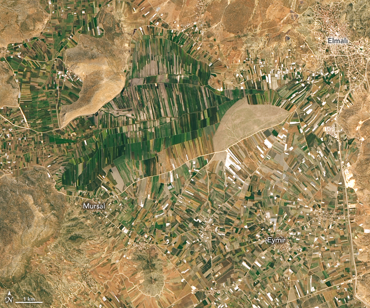
The images show two important agricultural districts of the Antalya province as they appeared on June 8, 2020, to the Operational Land Imager (OLI) on Landsat 8. Crop production in Antalya is valued around $270 million.
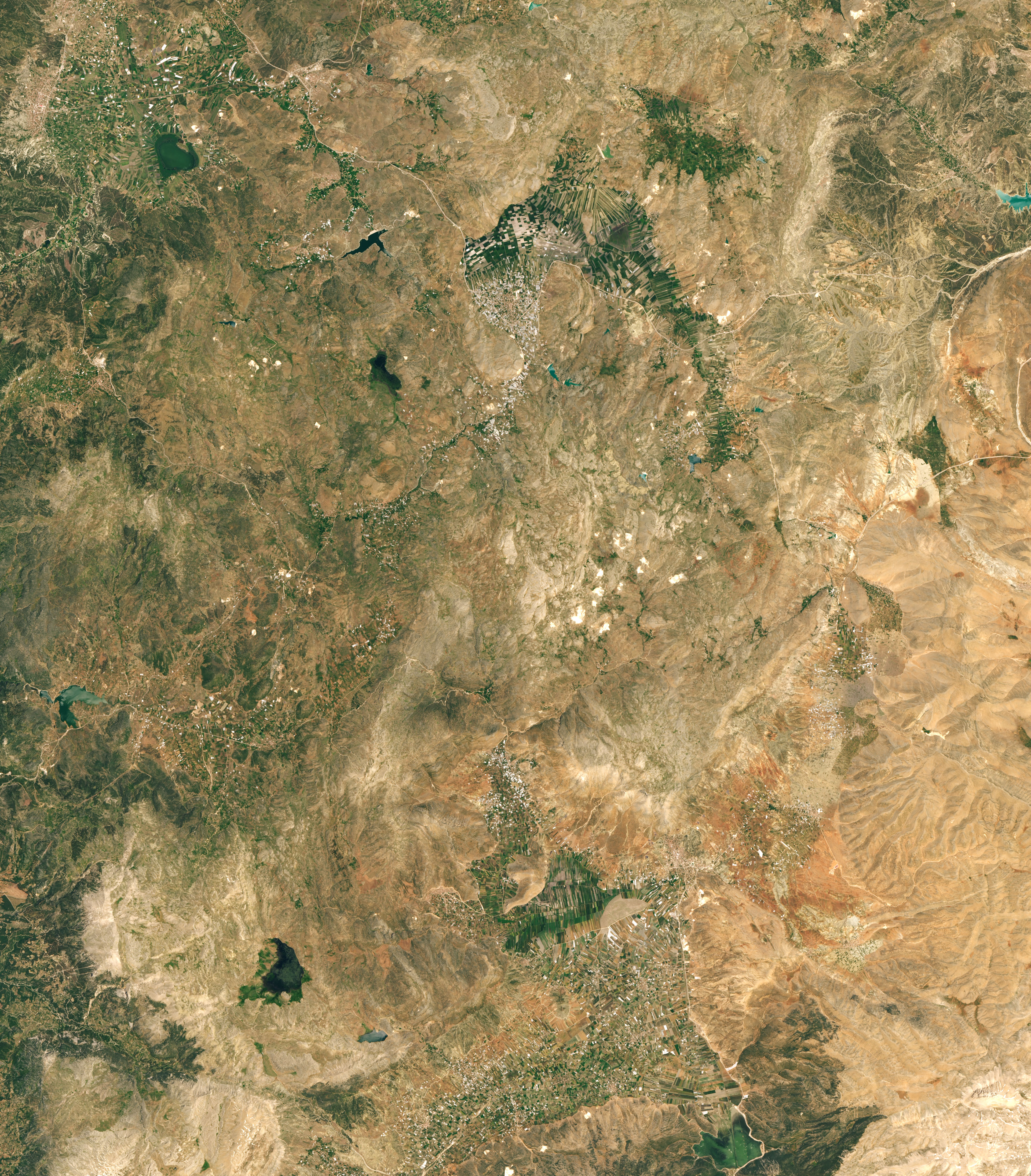
The first image shows farms in the district of Elmalı, where the town of the same name sits at the top of a long upland valley. Elmalı, which means “apple,” produces around 12 percent of Turkey’s apples, as well as the local chickpea snack leblebi. The second image shows a portion of the district Korkuteli, where farmers plant grains and oil seeds.
The arrangement of the farms conforms to the terrain of the Antalya province, which is largely mountainous. Drawing the northern border of Antalya, the Taurus Mountains cut across the province in the east to west direction in an arc. Elmalı and Korkuteli are located in the Bey Dağları mountains, the western range of the Taurus Mountains.
More than two million people live in villages located within the Taurus Mountains and rely on farming as their major source of income. Because of the terrain, farms are typically small (about 4 hectares or 10 acres).
References and Further Reading
- Basbug, T. and Gul, M. (2016) Analysis of Cost and Profitability for Enterprises Engaged in Greenhouse Cultivation in Highland Conditions: the Case of Elmalı, Antalya. Scientific Papers Series Management, Economic Engineering in Agriculture and Rural Development. 16 (2), 19-26.
- Ekran, O. et al. (2001) Sustainable Development of Small-Scale Farmers of the Taurus Mountains of Turkey. (Aleppo, Syria: ICARDA)
- Food and Agriculture Organization of the United Nations Turkey at a Glance. Accessed August 14, 2020.
- Food and Agriculture Organization of the United Nations (2003) Evaluation of activities of the private firms providing agricultural inputs with respect to extension in Elmalı and Korkuteli counties of Antalya province. Accessed August 14, 2020.
NASA Earth Observatory images by Lauren Dauphin, using Landsat data from the U.S. Geological Survey. Story by Kasha Patel.
This image record originally appeared on the Earth Observatory. Click here to view the full, original record.