Iceland’s Longest Fjord
Downloads
- akureyri_oli_2017207_lrg.jpg (5795x5604, JPEG)
Metadata
- Sensor(s):
- Landsat 8 - OLI
- Data Date: July 26, 2017
- Visualization Date: May 1, 2020
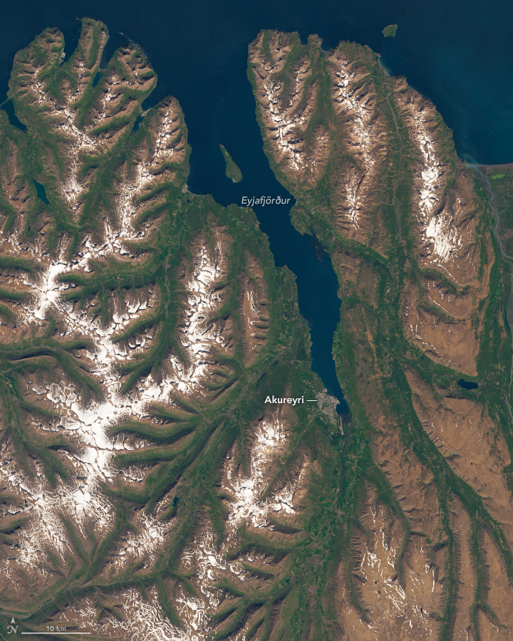
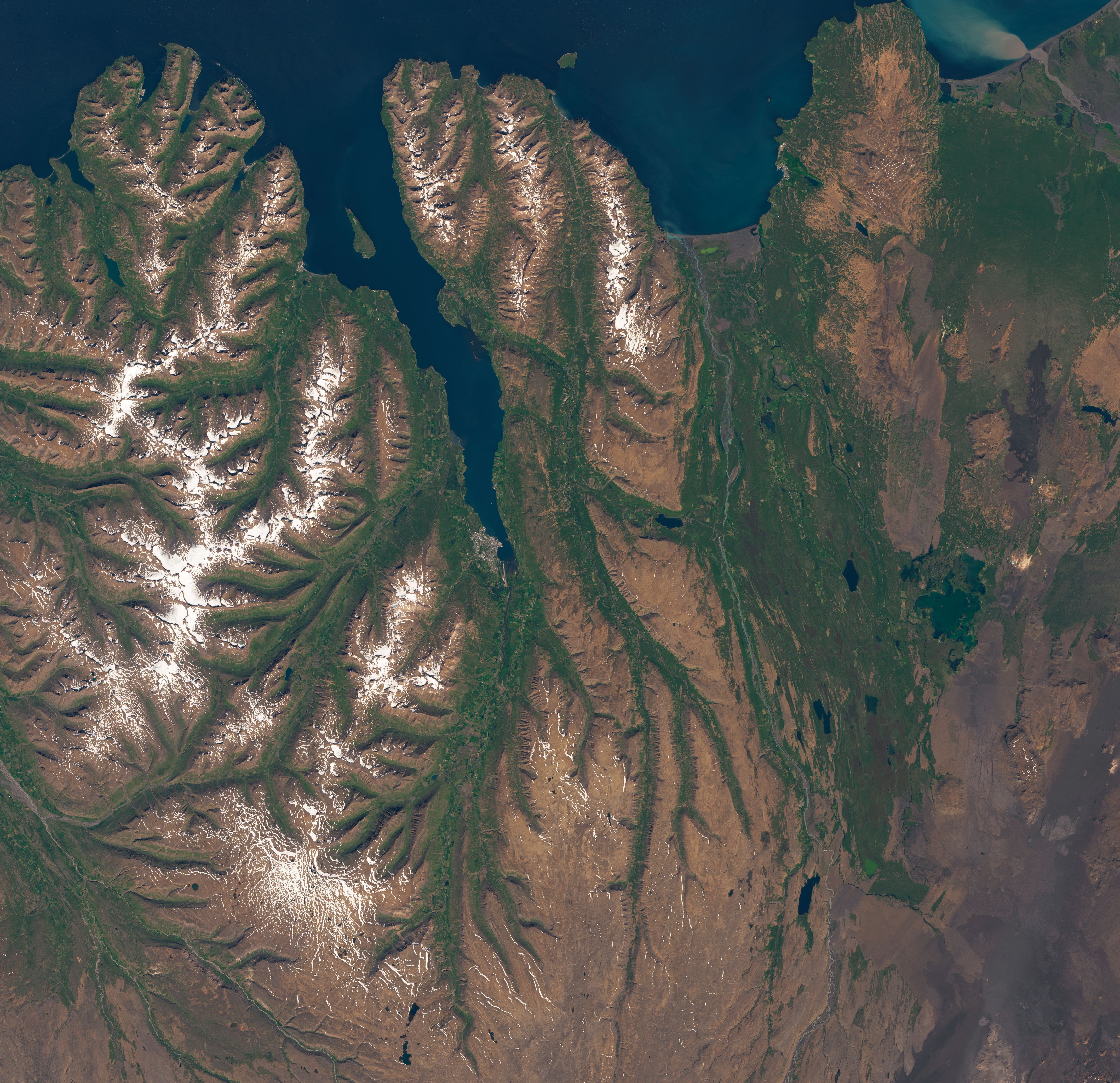
Most of the 109 fjords of Iceland are clustered in a small area in the east or around the large peninsula in the northwestern part of the island. There are just a handful of fjords along the northern coast. Among them is Eyjafjörður, Iceland’s longest fjord.
Eyjafjörður spans more than 60 kilometers (40 miles) from its mouth to Akureyri, a city known as Iceland’s “northern capital.” The Operational Land Imager (OLI) on Landsat 8 acquired this image of the fjord on July 26, 2017.
Eyjafjörður has become a prime destination for whales, scientists, and tourists. Humpback, bottlenose, blue, and minke whales frequent the sheltered, nutrient-rich waters to feed on plankton. Scientists are drawn to study the unusual hydrothermal vents found in its shallow waters. And with an ice-free port and a surprisingly mild climate, Akureyri is typically visited by more than 100 cruise ships per year.
The fjord was created by many thousands of years of glacial activity. When this part of Iceland was cooler and icier, glaciers carved the long, narrow valley by grinding against the land surface as they slid toward the sea. Over time, rising sea levels filled the valley to create the fjord.
South of the fjord, pastures and farms are concentrated in the valley. It is one of the few areas in the rugged, rocky terrain of Northern Iceland with a significant amount of farmland.
References
- BBC (2013, July 9) Iceland’s feisty capital of the north. Accessed January 17, 2020.
- European Environment Agency (2011, March 29) Iceland. Accessed January 17, 2020.
- Guide to Iceland Fjords in Iceland. Accessed January 17, 2020.
- Iceland Magazine (2017, August 28) Akureyri harbour named as one of world’s best cruise ship destinations. Accessed January 17, 2020.
- Lonely Planet (2018, March 13) Road tripping along Iceland’s longest fjord. Accessed January 17, 2020.
- Stanulla, R. et al. (2017) Structural, geochemical, and mineralogical investigation of active hydrothermal fluid discharges at Strýtan hydrothermal chimney, Akureyri Bay, Eyjafjörður region, Iceland. Geothermal Energy, 5, 8.
- X-Ray Mag (2015, January 6) Strýtan: Diving Iceland’s Hydrothermal Vents. Accessed January 17, 2020.
NASA Earth Observatory image by Lauren Dauphin, using Landsat data from the U.S. Geological Survey. Story by Adam Voiland.
This image record originally appeared on the Earth Observatory. Click here to view the full, original record.