Nishinoshima Puffs
Downloads
- nishinoshima_oli_20200026_lrg.jpg (2000x2000, JPEG)
Metadata
- Sensor(s):
- Landsat 8 - OLI
- Data Date: January 26, 2020
- Visualization Date: January 28, 2020
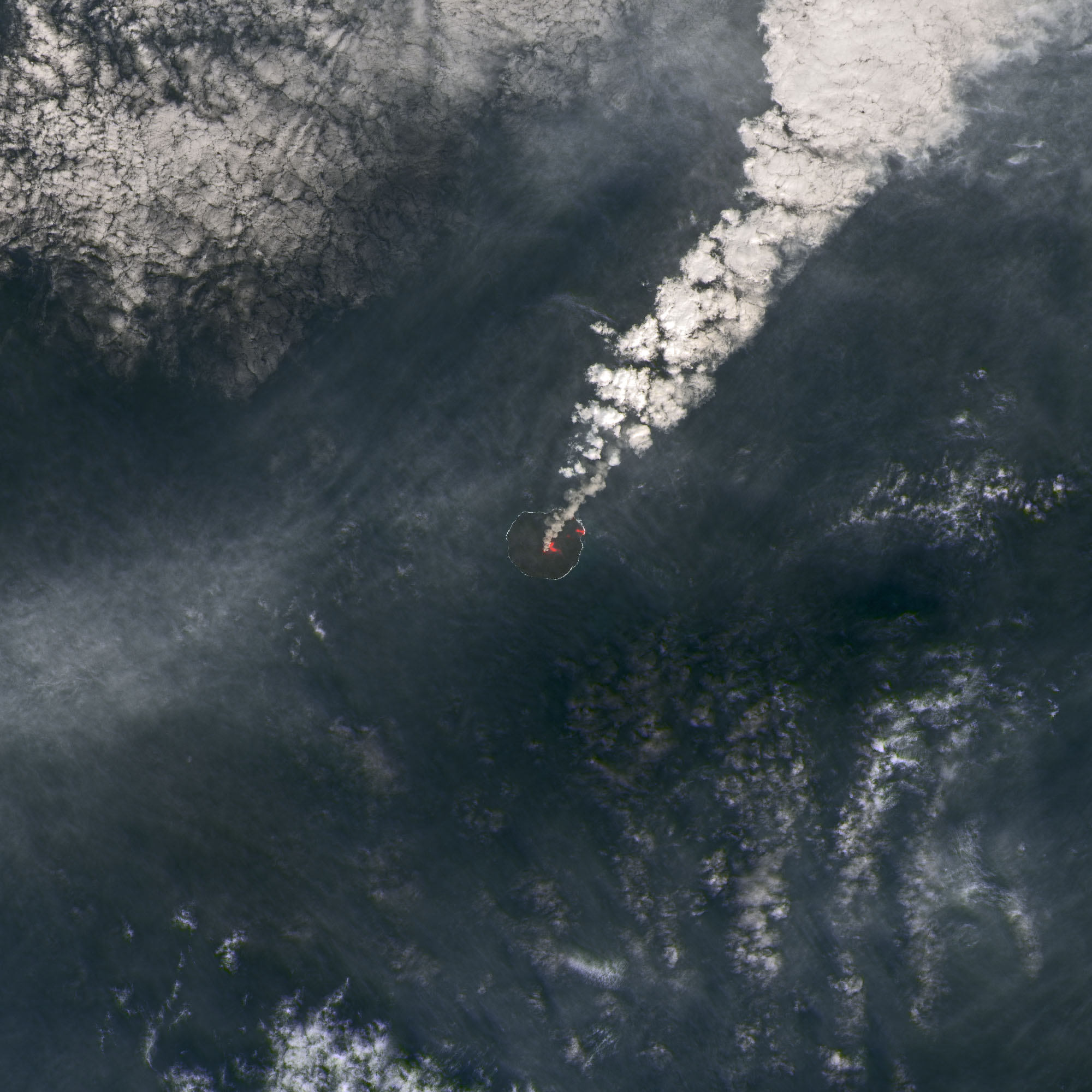
On January 26, 2020, the Operational Land Imager (OLI) on Landsat 8 captured this image of an ash and steam plume emanating from Japan’s Nishinoshima volcanic island, located roughly 1,000 kilometers (600 miles) south of Tokyo. In this image, infrared data is superimposed on a natural-color image to highlight active flows of the volcano. According to the Global Volcanism Program, lava flows traveled northeast and entered the ocean, generating steam plumes near the coastline. The Japan Coast Guard reported continuous emissions rising from January 15-21 from the central crater.
NASA Earth Observatory image by Joshua Stevens, using Landsat data from the U.S. Geological Survey. Text by Kasha Patel.
This image record originally appeared on the Earth Observatory. Click here to view the full, original record.