Fire Burns in Paraguay, Bolivia, and Brazil
Downloads
- bolivia_oli_2019237_lrg.jpg (3008x2332, JPEG)
- bolivia_oli_2019237_swir_lrg.jpg (3008x2332, JPEG)
Metadata
- Sensor(s):
- Landsat 8 - OLI
- Data Date: August 25, 2019
- Visualization Date: August 27, 2019
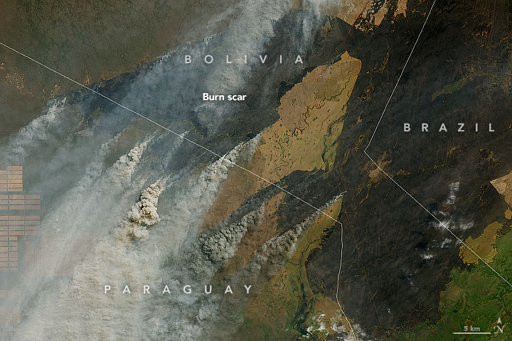
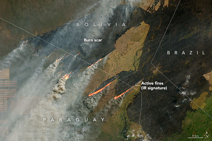
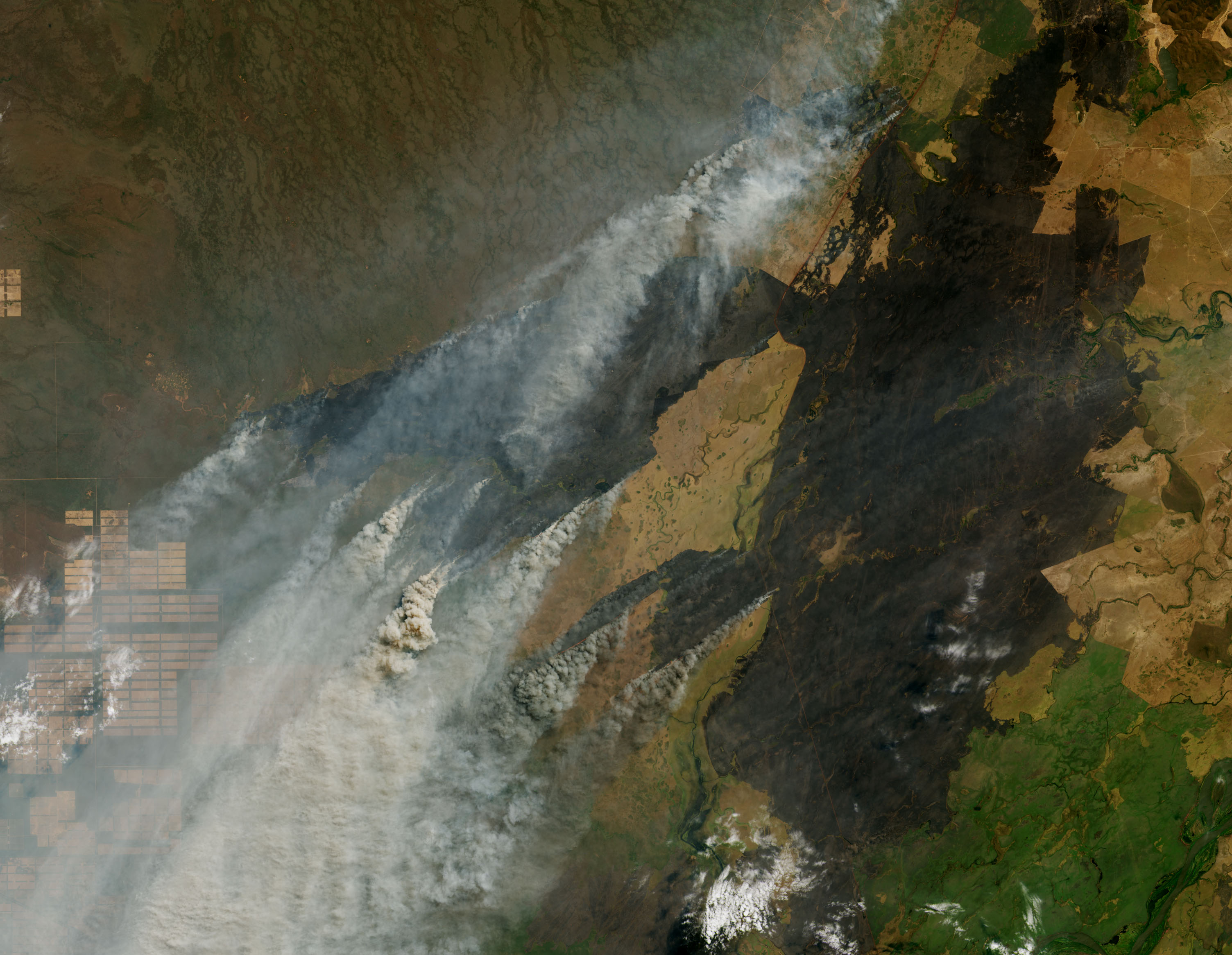
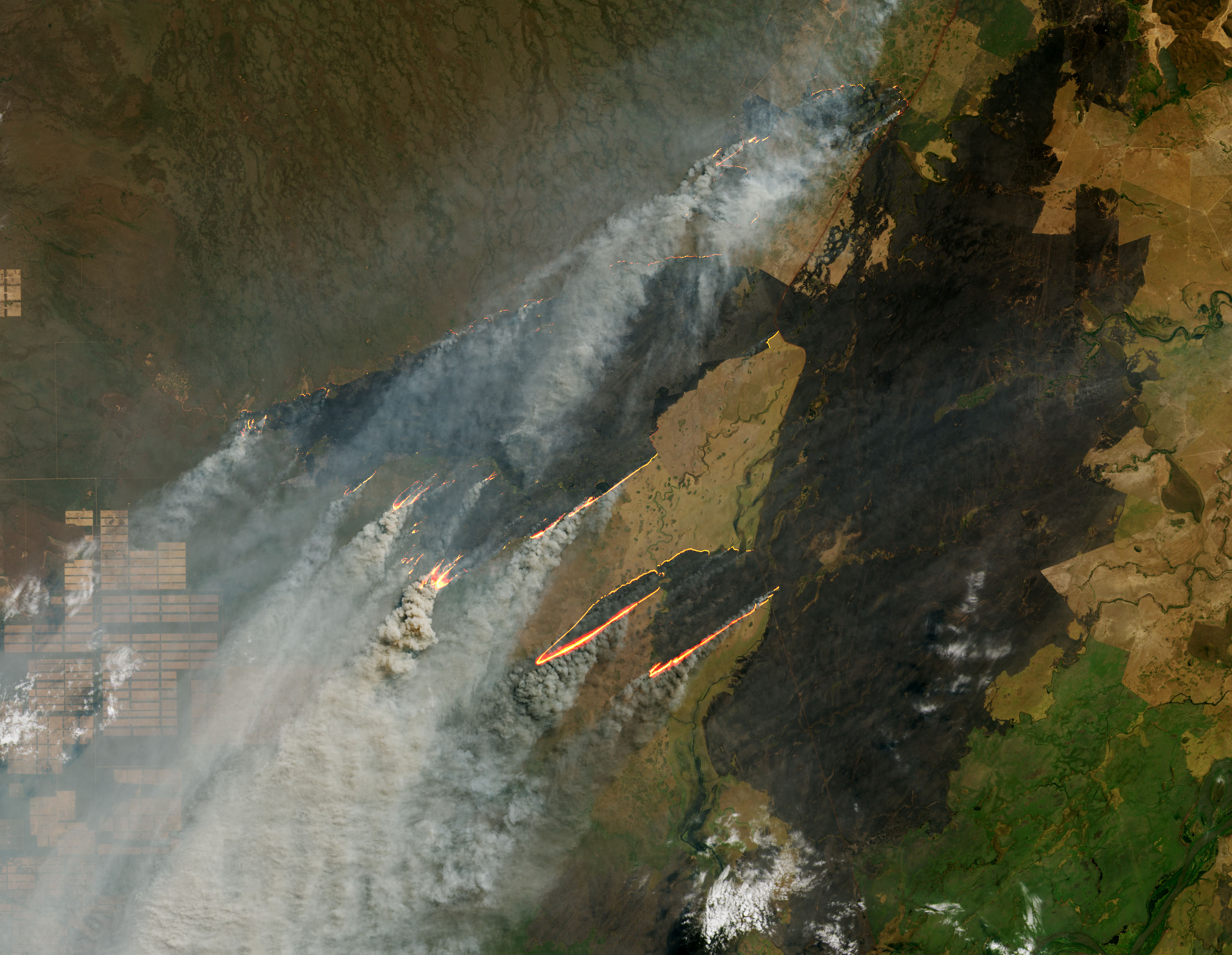
Since the beginning of August 2019, NASA satellites have observed several fires near the border of Bolivia, Paraguay, and Brazil. (Note that this area is not in the Amazon rainforest.)
On August 25, 2019, the Operational Land Imager (OLI) on Landsat 8 acquired images of one of the larger fires, which was burning north of the Paraguay River near Puerto Busch. The first image was made using OLI bands 4-3-2 (visible light). The second image includes observations of shortwave-infrared light in order to highlight the active fire. Recently burned areas appear black.
Images from NASA’s MODIS sensors indicate that this fire likely burned first in Paraguay and then spread into Bolivia and Brazil by August 19, 2019. You can view a rough time-series animation of the fires from August 1–26 by clicking here.
References and Further Reading
- NASA (2019, August 27) FIRMS: FAQ. Accessed August 27, 2019.
- NASA (2019, August 27) Worldview. Accessed August 27, 2019.
- NASA Earth Observatory Fire.
- NASA Earth Observatory (2019, August 21) Building a Long-Term Record of Fire.
NASA Earth Observatory images by Joshua Stevens, using Landsat data from the U.S. Geological Survey. Caption by Adam Voiland.
This image record originally appeared on the Earth Observatory. Click here to view the full, original record.